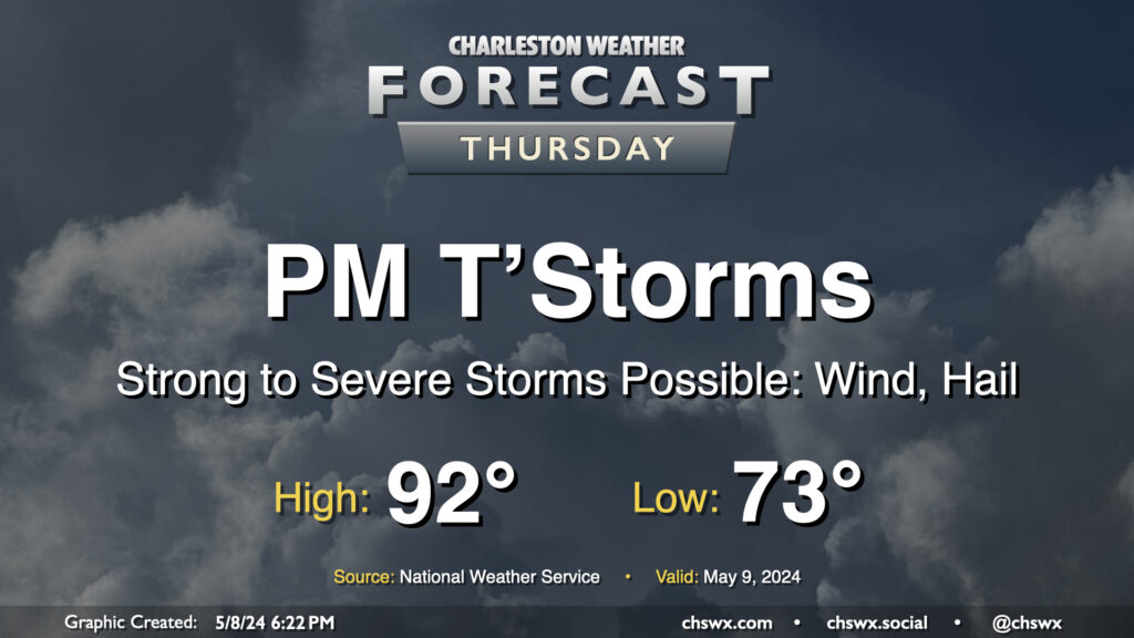
Thursday: Warm start, stormy finish

We get off to a warm start on Thursday — expect lows to only bottom out in the low to perhaps mid-70s with highs topping out in the low 90s and humidity making it feel closer to the upper 90s. The main weather story, though, will be the risk for some strong to severe thunderstorms moving through Thursday afternoon and into the evening. These could pack strong and potentially damaging wind gusts along with large hail. Exact timing is still unclear, but there is a risk these could coincide with the commute, so we’ll want to watch them closely. Stay close to reliable weather sources throughout the day for updates.
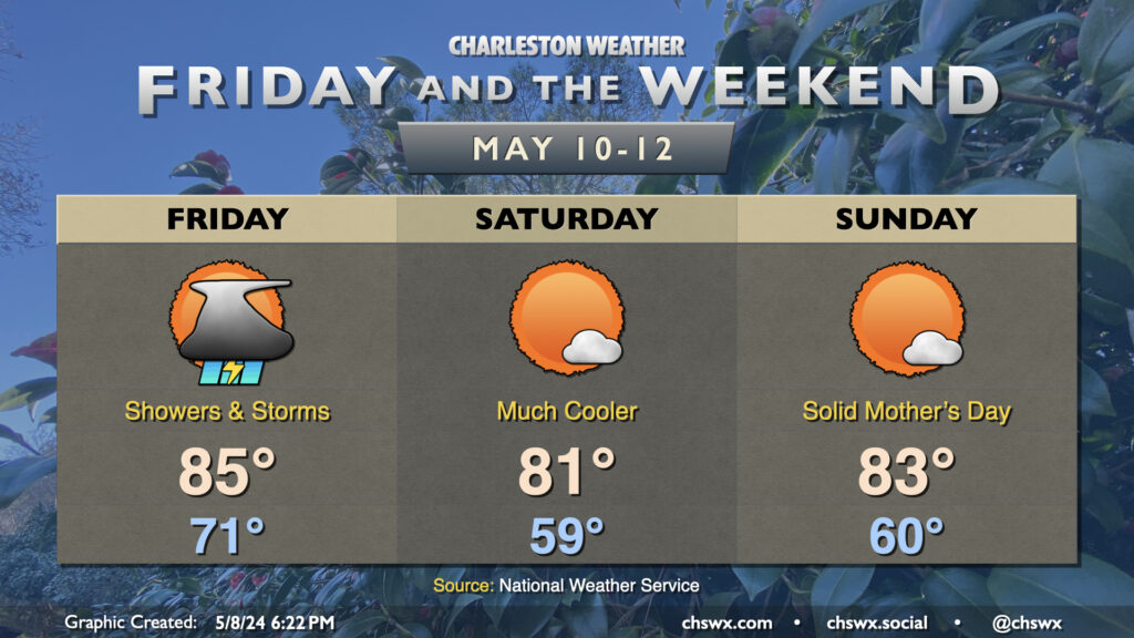
Friday & the weekend: One more stormy day, then a beautiful Mother’s Day weekend

We’ll have another round of storms to contend with Friday as a cold front moves through the area. Depending on what happens Thursday, the atmosphere could recover enough for these to be on the strong to severe side, but we’ll have to wait and see just how things play out. Temperatures will be somewhat subdued compared to the previous few days, with highs topping out in the mid-80s given the expected cloud cover, showers, and thunderstorms.
Once the front gets through late Friday, we’ll start to see cooler and drier air work into the area, yielding a beautiful weekend of weather for College of Charleston commencement and Mother’s Day. Temperatures each morning will run in the upper 50s to around 60°, and highs will top out in the low 80s, right around mid-May normals for around here. Enjoy it, because it’ll be June before you know it.
Follow my Charleston Weather updates on Mastodon, Bluesky, Instagram, Facebook, or directly in a feed reader. Do you like what you see here? Please consider supporting my independent, hype-averse weather journalism and become a supporter on Patreon for a broader look at all things #chswx!