Thursday: A stretch of less-humid weather begins
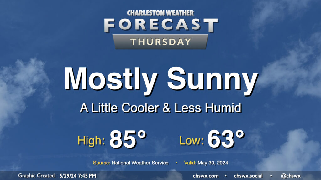
A dry front is getting through tonight, and that will open the door for a really pleasant ending to May. Temperatures start in the low-to-mid-60s, which is a few degrees below normal for May 30. We’ll warm to the mid-80s in the afternoon under mostly sunny skies, right near climatological norms for this point in the year. Dewpoints will mix out to around 50° during the day, which should keep the warmth more on the comfortable side than not.
Friday & the weekend: A couple more below-normal temperature days, then warming begins
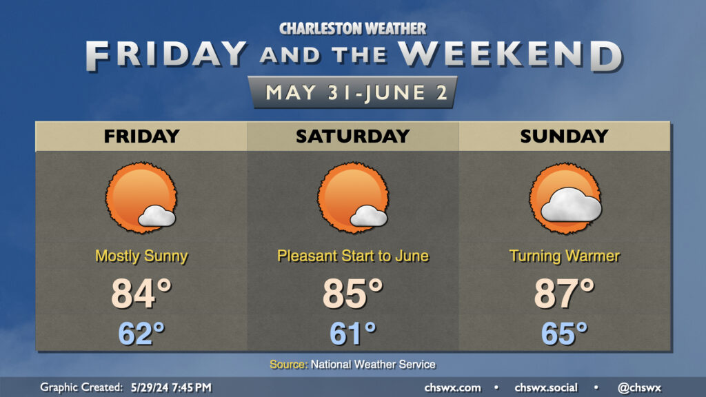
Temperatures will continue to run below normal with comfortable humidity through Saturday, with mostly sunny skies expected as high pressure remains in control. We’ll start to see a warming trend begin Sunday, though, as high pressure begins to shift more offshore, bringing higher-dewpoint air back into the area for next week. This will eventually lead to the return of standard afternoon 20% thunderstorm chances heading into midweek.
Follow my Charleston Weather updates on Mastodon, Bluesky, Instagram, Facebook, or directly in a feed reader. Do you like what you see here? Please consider supporting my independent, hype-averse weather journalism and become a supporter on Patreon for a broader look at all things #chswx!