Tuesday: Another hot day with a few storms
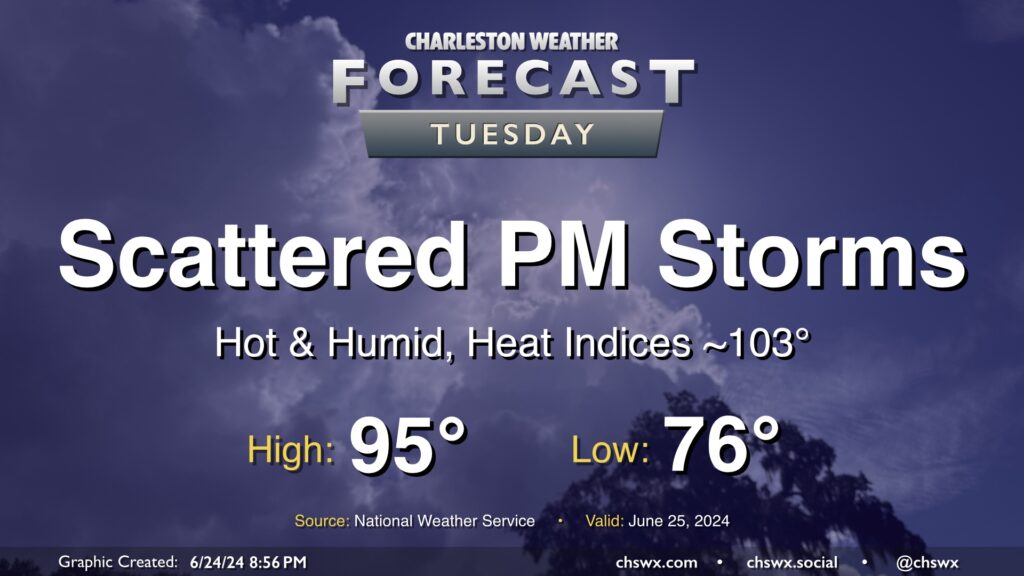
Another hot summer day lies ahead for Tuesday, with just a few of us possibly seeing some relief from thunderstorms in the afternoon. We start the day in the mid-70s, warming to the mid-90s in the afternoon. Dewpoints in the low to mid-70s will make it feel closer to 103° at times, with even warmer heat indices possible in the wake of the seabreeze.
As mentioned, a few thunderstorms will be possible with a stalled front in the area, but not everyone will see a storm. A stronger storm or two can never be ruled out this time of year, but there is not a widespread risk for severe weather.
Rest of the work week: Staying steamy and a little stormy
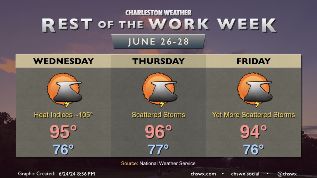
Hot days continue for the rest of the work week with scattered showers and thunderstorms possible each afternoon and evening. Temperatures will continue to run in the mid-90s each afternoon after balmy starts in the mid-70s (and perhaps not getting below 80° near the beaches). Mid-70s dewpoints will help drive heat indices well into the 100s each afternoon, too, and so you will want to be sure you’re taking frequent water breaks if you’re going to be outside. Thunderstorms will help cool some of us off, but not everyone will see a storm. (So it goes in the summer.)