Weekend forecast: Steamy & stormy
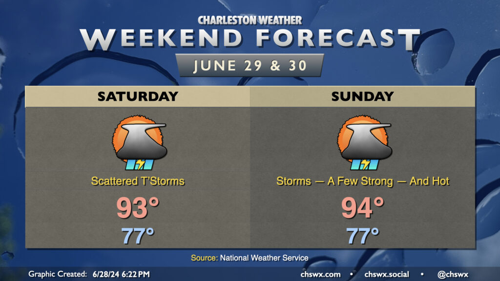
The weekend’s forecast will feature continued summer heat and humidity with showers and thunderstorms each afternoon.
We’ll start Saturday in the mid-to-upper 70s away from the coast, warming to the low to mid-90s in the afternoon. Dewpoints will be on the rebound after a slightly drier Friday, but heat indices should stay below the Heat Advisory threshold of 108° for one more day. That being said, it’ll still be plenty hot: it’ll feel like 103-105° at the height of the afternoon. The seabreeze will be the focal point for scattered thunderstorm development in the afternoon, with additional storms firing off outflow boundaries. Some of us may see a storm to cool us off, but others will not. High-resolution guidance is pointing at areas along and west of 17-A for the best chance for storms.
More widespread storms are possible Sunday ahead of another “cold” front that’ll be moving in from the north. Ahead of this front and before storms kick off, air temperatures could head into the mid-90s. This, combined with an increasingly humid airmass, could send heat indices toward the upper 100s and, after a couple days off, another Heat Advisory. Many of us should see relief, though, as showers and thunderstorms develop in the afternoon through the evening via the seabreeze, outflow boundaries, and the approaching front. A couple storms could be on the stronger side with damaging wind gusts the main concern as well, so be aware of that possibility.
Tropics heating up as TD Two, likely future Beryl, forms
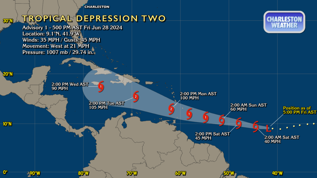
Tropical Depression Two has been classified this evening just west of 40°W — rather far to the east given that it’s late June. It’s expected to become Beryl by tomorrow, and could become the first hurricane of the 2024 season before the weekend is out as it heads toward the Lesser Antilles. It’ll then get into the Caribbean by mid-week, where the forecast shows some weakening as it encounters an increasingly hostile environment.
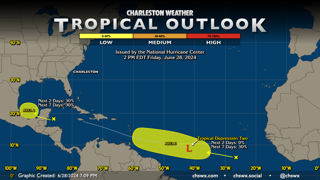
In addition to Tropical Depression Two, there are two other areas of interest in the Atlantic basin. The first area in the Bay of Campeche has a low chance of development and won’t be a concern here in the Carolinas. The second area (labeled Area 3 because the outlook hadn’t yet been updated to remove Area Two, which became TD Two) is hot on the heels of Tropical Depression Two, and could slowly develop as we get into next week. We’ll keep an eye on this one for now. The good news is that there are no imminent concerns for the Lowcountry, but this activity’s a good reminder to get prepared for what certainly seems like a rather busy season ahead.
Follow my Charleston Weather updates on Mastodon, Bluesky, Instagram, Facebook, or directly in a feed reader. Do you like what you see here? Please consider supporting my independent, hype-averse weather journalism and become a supporter on Patreon for a broader look at all things #chswx!