Thursday: Spotty evening storms, still rather warm
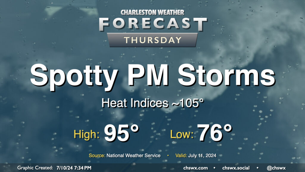
A stalling front will briefly usher in slightly drier air on Thursday, helping to keep heat indices below heat advisory levels, but it’ll still be plenty warm with air temperatures peaking in the mid-90s and heat indices in the mid-100s expected. We should still see a few showers and thunderstorms pop in the afternoon, but like Wednesday, coverage should be reasonably limited.
Friday & the weekend: More widespread storms return
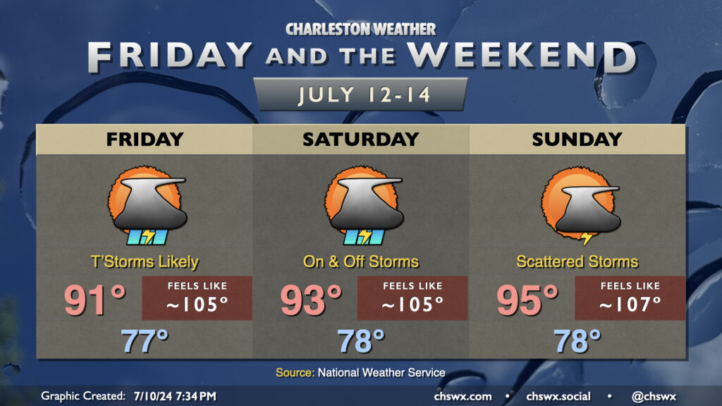
The aforementioned stalled front will still be hanging around heading into the weekend, and waves of low pressure along it plus some more upper-level energy will instigate more in the way of showers and thunderstorms Friday and Saturday, particularly in the afternoon and evening hours. We stay in the steam bath, though to a slightly lesser degree, thanks to the increased coverage of showers and storms. However, highs still peak in the low 90s, and heat indices continue to look to peak around 105° each afternoon. Coverage may let up a little bit Sunday as the front retreats inland and washes out; our reward is highs in the mid-90s and heat indices once again uncomfortably flirting with the advisory threshold of 108°.
Follow my Charleston Weather updates on Mastodon, Bluesky, Instagram, Facebook, or directly in a feed reader. Do you like what you see here? Please consider supporting my independent, hype-averse weather journalism and become a supporter on Patreon for a broader look at all things #chswx!