Tuesday: A little hotter with a few storms in the afternoon
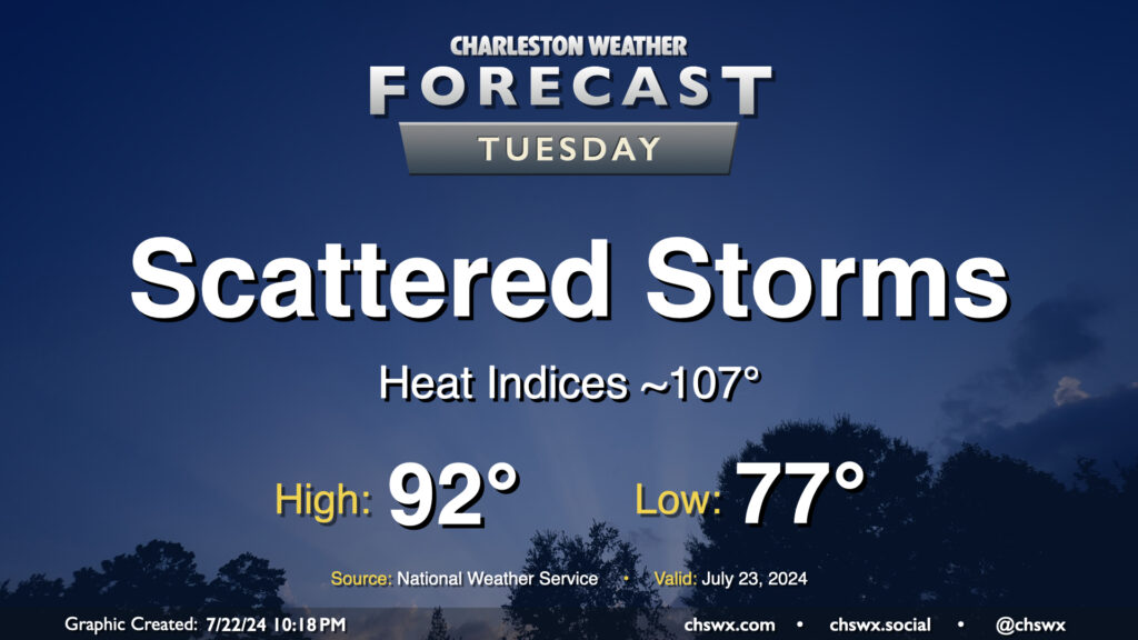
Heat and humidity will continue to rule the roost for Tuesday and for the next couple days as we stay within southerly flow at the surface and aloft, keeping the moisture pump moving right along. This will also lead to periods of storms. Guidance is hinting at another round of morning showers and storms near the coast as the land breeze develops before afternoon storms develop further inland. Coverage will generally be scattered in nature, and not all of us will see rain as a result. Highs top out in the low 90s after a start in the upper 70s; expect heat indices to get close to advisory criteria in the afternoon, perhaps approaching 107°.
Rest of the work week: Still warm, but storms tick up
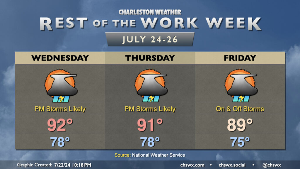
We stay quite warm as we progress into mid-week, though a front and its accompanying uptick in shower and storm chances could help suppress temperatures a bit later this week. Heat indices look to approach if not exceed the Heat Advisory criteria of 108° on Wednesday before showers and thunderstorms fire in the afternoon and early evening hours. We’ll still see rather oppressive heat on Thursday, though we should fall just short of advisory criteria as air temperatures look to run a degree or two cooler than Wednesday. Air temperatures continue to tick downward slightly on Friday, but that will likely be due to an increase in clouds and rain as a front tries to get close to the area with on and off storms expected. Overall, expect things to stay active for the next several days, with more much-needed rain in the offing.
Follow my Charleston Weather updates on Mastodon, Bluesky, Instagram, Facebook, or directly in a feed reader. Do you like what you see here? Please consider supporting my independent, hype-averse weather journalism and become a supporter on Patreon for a broader look at all things #chswx!