Thursday: Turning stormier

More active weather is expected Thursday as a stalled front combines with a favorable upper-air configuration and plenty of available moisture for numerous showers and thunderstorms. While it won’t rain all day at any one location, be ready for downpours to affect your day. We could see showers and storms fire overnight near the coast, in fact, and those could impact the morning commute, while guidance continues to paint solid afternoon thunderstorm chances as well.
This at least helps drives temperatures down a touch: while the low of 77° is still quite balmy, highs top out in the low 90s at best with heat indices running lower than they have on previous days. (A meteorological Pyrrhic victory, perhaps, but so it goes in late July.)
Friday & the weekend: Staying unsettled, though a little quieter Sunday
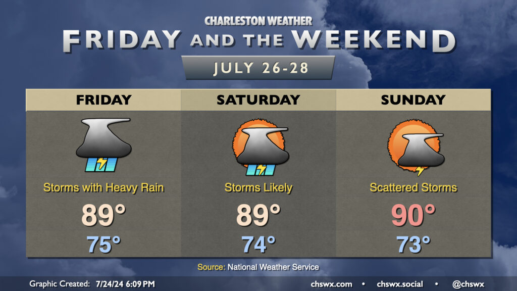
Unsettled weather continues for Friday into the weekend, though coverage starts to tamp down a little Sunday as high pressure aligns a little more overhead. Friday could be particularly busy as a front meanders close by, with the potential for some flooding and a low-end chance for a severe storm or two as well. Saturday should show fairly decent storm coverage in the afternoon as well, while the aforementioned high pressure brings coverage to a more seasonable scattering on Sunday.
Temperatures aren’t as blazing hot thanks to not only the expectation for clouds and rain, but also because of a front that’ll get enough oomph to push south of the area. It’ll knock lows and dewpoints down a bit and help keep temperatures from getting too far out of hand, though we should touch 90° again by Sunday.
Follow my Charleston Weather updates on Mastodon, Bluesky, Instagram, Facebook, or directly in a feed reader. Do you like what you see here? Please consider supporting my independent, hype-averse weather journalism and become a supporter on Patreon for a broader look at all things #chswx!