Tuesday: Scattering of storms continues, but a respite is in sight

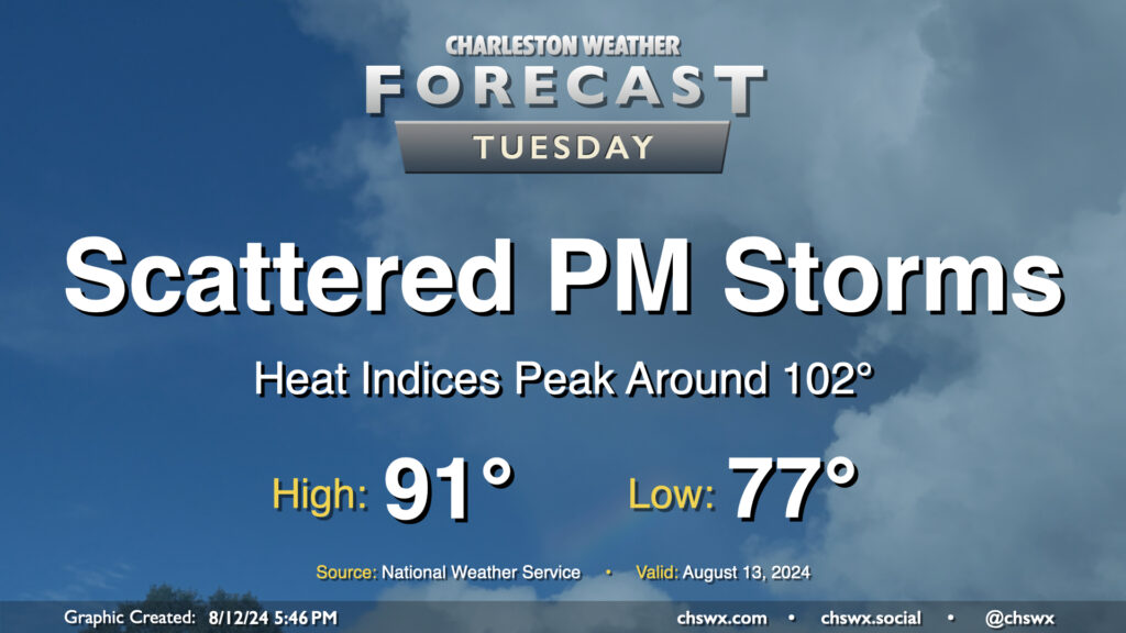
Tuesday’s forecast will continue to feature warm temperatures and afternoon thunderstorms as Berkeley and Charleston head back to school. We have another warm start ahead of us — generally expect lows in the upper 70s once again, followed by highs in the low 90s in the afternoon. This should run a couple degrees cooler with a little more onshore flow, but it’ll still be toasty with heat indices peaking around 102° before showers and storms fire. Once again, heavy downpours could cause localized flooding, especially near swollen rivers and streams and in urban areas, so stay alert for possible Flood Advisories.
Latest on flooding

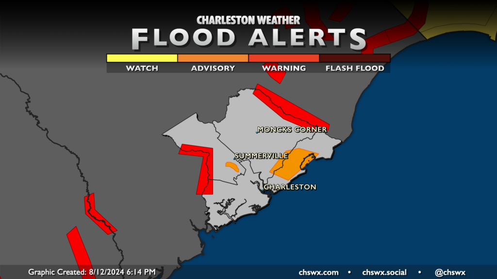
The National Weather Service dropped the blanket Flood Warning for Berkeley, Colleton, and Dorchester counties this morning, moving forward with more targeted warning polygons where flooding remains the greatest. Thus, River Flood Warnings continue for the Edisto at Givhans Ferry and the Santee River near Jamestown as Debby’s deluge continues to drain out. Meanwhile, a Flood Advisory is out along the Ashley River where flooding continues in parts of Summerville. (You’ll also see a flood advisory up in Charleston County on this map, but that’s for thunderstorm-induced flooding and is not Debby-related.)
Water levels will remain at flood stage along the Santee and Edisto rivers for the foreseeable future, but will slowly continue to drain out over the next couple weeks. If you’re traveling around these areas highlighted by Flood Advisories or Warnings, be sure not to go around any road that’s covered by water, barricaded or otherwise.
Rest of the work week

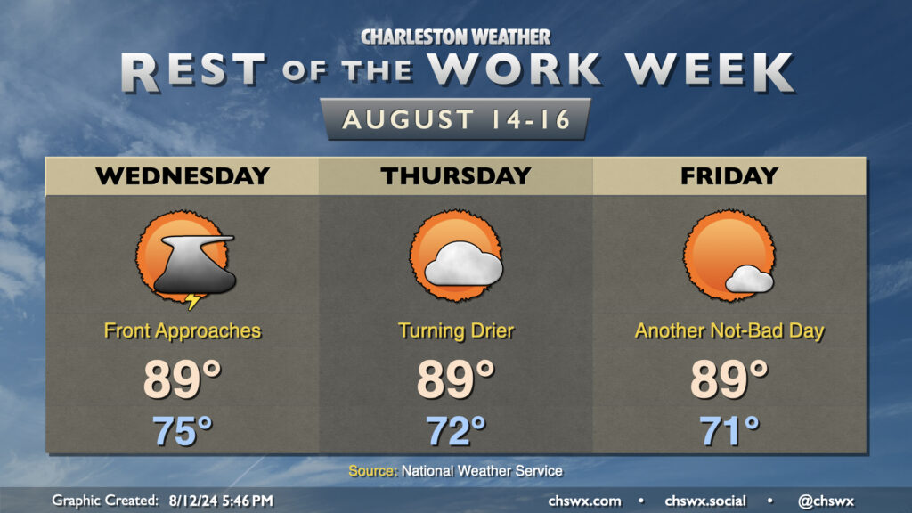
Improving weather will characterize the second half of the work week as a front slides southward and stalls out, allowing high pressure to ridge down into the area with some drier and slightly cooler air. That front will approach and move through on Wednesday, with showers and thunderstorms remaining possible as some moisture lingers post-frontal passage. It turns drier on Thursday and Friday, though, with ample sunshine both days helping to send highs up to the upper 80s, but dewpoints will mix out to the upper 60s on Thursday and perhaps as low as the mid-60s on Friday. This will allow for some cooler starts than we’ve seen recently, too, with lows bottoming out in the low 70s in the metro and perhaps even some upper 60s further inland and in rural areas. It’s not quite the fall-like snap many of us are looking forward to, but it’s certainly an improvement over where we’ve been temperature-wise as of late.
Tropical Storm Ernesto forms; no threat to the Lowcountry

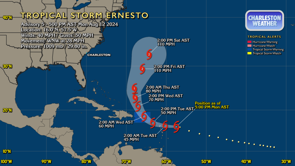
Finally, Tropical Storm Ernesto has formed from Potential Tropical Cyclone Five this evening. As of the 5PM advisory, it had 40 MPH winds and was moving WNW at 28 MPH. It’s expected to gradually gain strength as it approaches the Virgin Islands and Puerto Rico, where Tropical Storm Warnings are out. The trough bringing us our shot of drier air will also help to turn the storm northward and away from the continental US later this week, so Ernesto continues to not be a concern for our weather aside from maybe a little surf at some point. (Keep an eye on this in Bermuda, though.)
Elsewhere in the tropics, things remain generally quiet, though expect an uptick in activity over the next few weeks as we start to move into the climatological peak of the season. We’ll be watching. In the meantime, though, there’s nothing for us to worry about.
Follow my Charleston Weather updates on Mastodon, Bluesky, Instagram, Facebook, or directly in a feed reader. Do you like what you see here? Please consider supporting my independent, hype-averse weather journalism and become a supporter on Patreon for a broader look at all things #chswx!