Tuesday: Scattered storms continue as a front meanders nearby
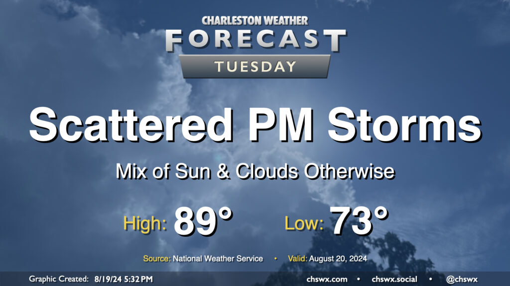
Tuesday looks a lot like Monday did (in the weather department, anyway) as a front continues to meander nearby, keeping the risk for a few showers and thunderstorms in the forecast in the afternoon primarily east of 17-A. Temperatures will follow a similar curve as well — we start in the low 70s (warmer toward the coast) and warm into the upper 80s to around 90° in the afternoon.
As far as storms go, a few folks could see some locally heavy rain thanks to slow storm motions, but otherwise, no severe weather is expected.
Rest of the work week: Cooling trend kicks in
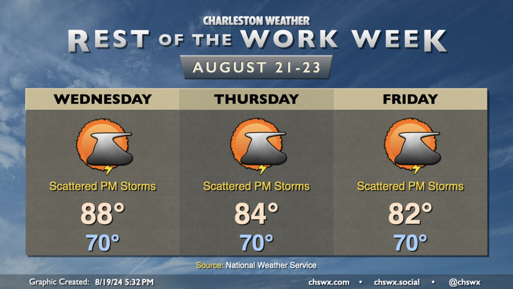
We’ll keep storm chances each afternoon as a front lingers nearby, but high pressure wedging southward will start to cool us off fairly noticeably especially as we get into the second half of the week. High temperatures will fall each day, going from 88° on Wednesday to 84° on Thursday before bottoming out around 82° on Friday. (From there, we’ll warm back up.) This is going to be an early preview of the traditional wedge of high pressure that often starts to set up in the cool season, complete with increased cloud cover and the potential for some showers and storms. In August, though, we don’t hate the wedge quite as much!
We’ll need to keep an eye on tidal trends as we get later into the week, though, as northeasterly winds and the ongoing lunar perigee (aka “supermoon”) could drive an elevated coastal flooding threat around high tides as we head toward the weekend.
Follow my Charleston Weather updates on Mastodon, Bluesky, Instagram, Facebook, or directly in a feed reader. Do you like what you see here? Please consider supporting my independent, hype-averse weather journalism and become a supporter on Patreon for a broader look at all things #chswx!