Thursday: Comfortable temperatures, clouds increasing, shower possible late
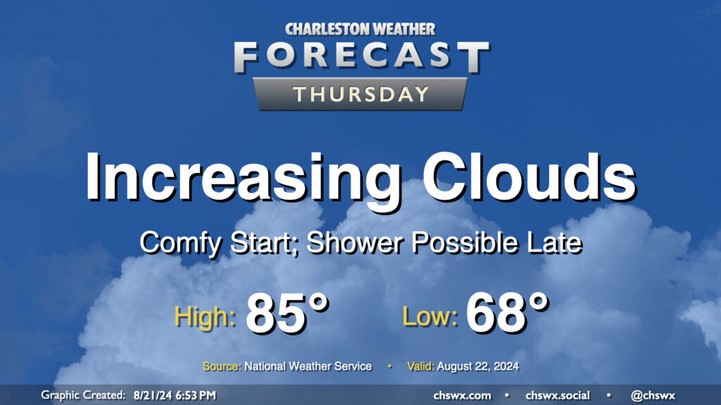
We’ve got a reasonably comfortable day (especially as late August goes) for Thursday as cool high pressure continues to rule the meteorological roost in our neck of the woods. We start the day in the upper 60s in much of the metro, likely dropping even lower further inland and in more rural locations. Temperatures should warm to the mid-80s in the afternoon, but humidity will be quite tolerable with mid-60s dewpoints expected. Clouds will be on the increase as a coastal trough takes shape, and there will be a risk for a shower near the coast, but much of us get the day in rain-free.
Friday & the weekend: Warming back up
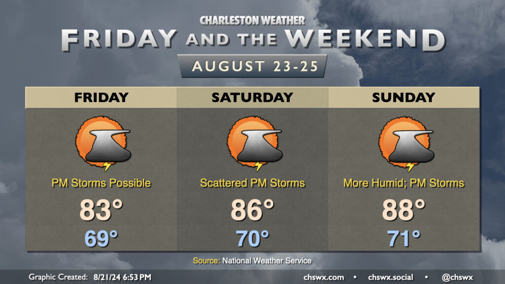
Friday will be another seasonably cool day across the area, with temperatures once again starting in the upper 60s and warming to the low 80s in the afternoon. We’ll see dewpoints creep up a little more as a surface trough continues to hang out nearby, and this combined with a little bit of mid-level energy could stir up some afternoon thunderstorms, especially near the coast where the best moisture will be found.
Temperatures will then trend warmer as a ridge tries to nudge in from the west. Expect mid-80s on Saturday and upper 80s on Sunday, with dewpoints continuing their slow rise into the low 70s by Sunday. Afternoon showers and thunderstorms will continue to be a possibility, especially the further east you go as dry air attempts to hang tough inland.
Coastal flood risk through the rest of the week
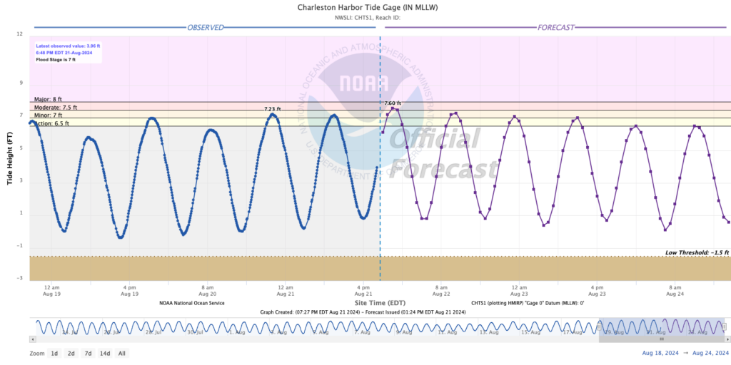
Coastal flooding will remain a concern at times of high tide for the rest of the work week as onshore flow and lingering effects from the recent full moon at perigee continue to drive tidal departures up. A Coastal Flood Advisory is in effect Wednesday night from 8PM-midnight for water levels 7.5-7.7′, which produces moderate flooding that can close roads in downtown Charleston. Water levels will continue to punch into minor flood stage during each high tide cycle through midday Friday, so expect additional Coastal Flood Advisories from the National Weather Service as a result. The coastal flood threat lessens over the weekend as the astronomical influences continue to wane.
Follow my Charleston Weather updates on Mastodon, Bluesky, Instagram, Facebook, or directly in a feed reader. Do you like what you see here? Please consider supporting my independent, hype-averse weather journalism and become a supporter on Patreon for a broader look at all things #chswx!