Tuesday: High pressure assumes control
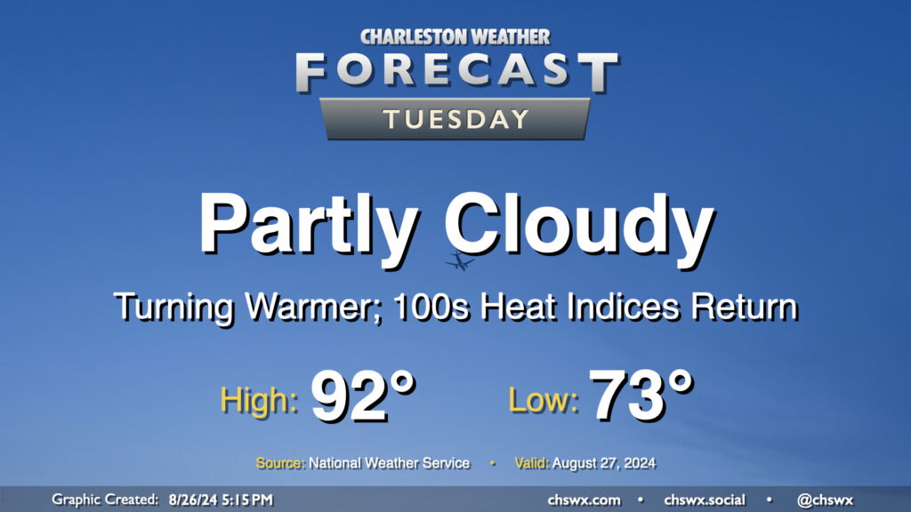
High pressure will bring a pause in the rain and a further uptick in temperatures starting Tuesday. We start the day in the low to mid-70s (warmer near the coast), warming to the low 90s in the afternoon under partly cloudy to mostly sunny skies. With 70s dewpoints continuing their comeback, expect heat indices in the low 100s to return to the area as well — a fair bit warmer than we’ve been used to recently, but staying below the heat advisory thresholds we got to know very well during July.
Rest of the work week: High pressure continues its reign
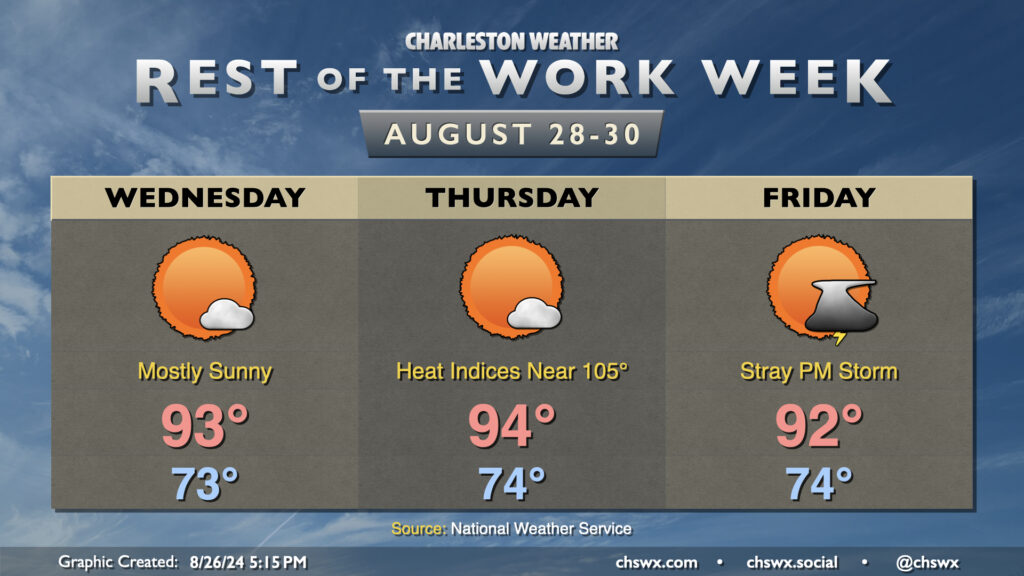
High pressure remains in control for much of the rest of the work week, bringing mostly sunny skies and toasty temperatures. Expect low to mid-90s on Wednesday and Thursday, with heat indices pushing to around 103° on Wednesday and near 105° on Thursday. The heat peaks Thursday, though, as the deep-layer ridge begins to lose a little influence on Friday. We’ll still see warm temperatures, though air temperatures will run a degree or two cooler than they did Thursday. The weakening ridge will also make it a little more likely that a few updrafts break through and develop a stray storm or two in the afternoon, but the majority of us look to notch another rain-free day.
Follow my Charleston Weather updates on Mastodon, Bluesky, Instagram, Facebook, or directly in a feed reader. Do you like what you see here? Please consider supporting my independent, hype-averse weather journalism and become a supporter on Patreon for a broader look at all things #chswx!