Thursday: Staying breezy and on the cool side with a shower possible
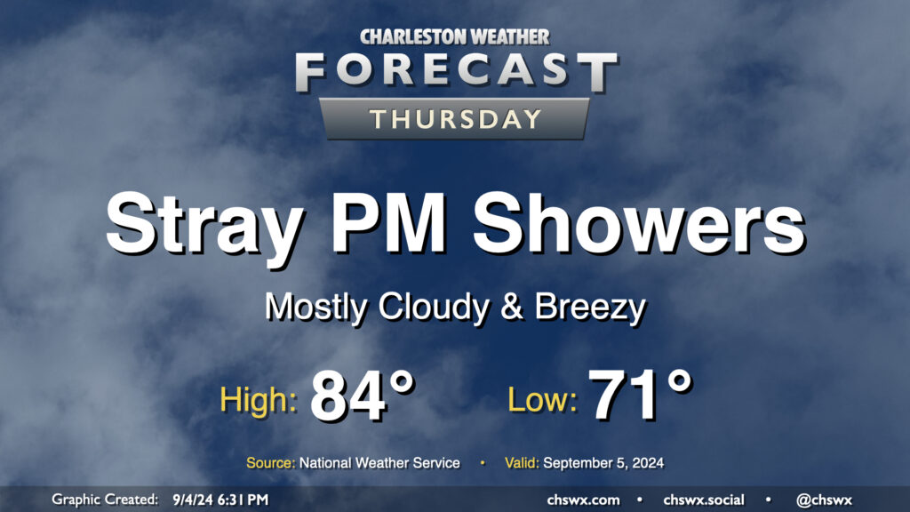
The wedge of high pressure that’s kept things breezy and cool but largely quiet hangs on for one more day Thursday. We’ll start the day in the low 70s, warming to the mid-80s in the afternoon under a mix of sun and clouds. Breezy conditions with gusts 20-25 MPH will continue to be possible as the pressure gradient stays pinched, and we’ll keep the risk of a shower or two primarily in the afternoon. The best chance for any rain will be closer to the coast, though much of us look to get the day in rain-free.
Friday & the weekend: Low pressure increases rain chances Friday into Saturday
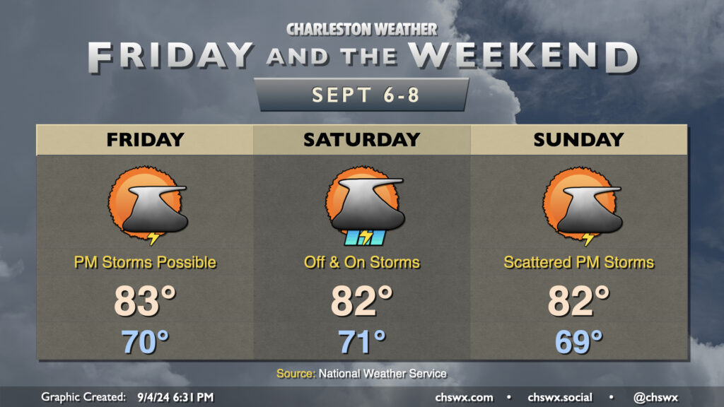
Low pressure along the stalled front to our south will move across the Gulf and cause the front to buckle northward as we get into Friday and Saturday. Rain chances look to peak overnight Friday into Saturday as the low makes its closest approach. Rain could turn heavy at times, but severe weather doesn’t appear to be a concern at this point. The low clears the area to give us a bit of a break on Sunday, though shower chances should return in the afternoon and evening as another wave of low pressure passes by.
We stay firmly on the cool side of normal as northerly to northeasterly winds continue to blow into the area. While we start the day around 70° each day, highs only get to the low 80s each afternoon thanks to the northeasterly winds as well as some cloud cover. A reinforcing front keeps us cool on Sunday, and we’ll look to stay below normal to start next week as well.
Follow my Charleston Weather updates on Mastodon, Bluesky, Instagram, Facebook, or directly in a feed reader. Do you like what you see here? Please consider supporting my independent, hype-averse weather journalism and become a supporter on Patreon for a broader look at all things #chswx!