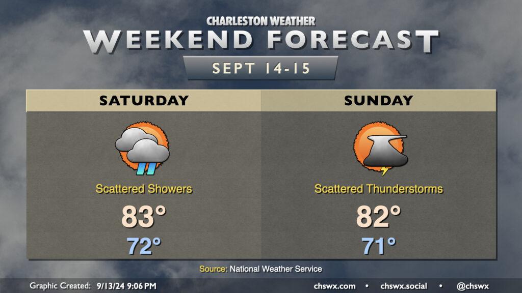
Weekend forecast: Breezy with some showers as low pressure spins up offshore
A complex forecast lies ahead this weekend as we monitor for the potential for low pressure to spin up off the coast, which has a shot at potentially becoming tropical as it approaches the coast early next week.
In the meantime, we find ourselves within the high pressure wedge of the past several days. This keeps cloud cover and cooler-than-normal highs in place for the weekend, with the potential for scattered showers as well. The northeast breeze will continue to get stronger, especially near the coast, as the pressure gradient between high pressure anchored to the northeast and low pressure developing offshore tightens further.
On Saturday, some periods of showers will be possible, but an all-day rain is not expected. We will start in the low 70s once again, warming to the low to mid-80s in the afternoon. Expect winds to generally run about 10-15 MPH out of the northeast, with 15-20 MPH winds expected at the coast (with locally higher gusts).
Sunday is when forecast confidence starts to get a little shaky depending on the development of low pressure offshore as the model guidance really hasn’t come into lockstep entirely just yet. For now, expect generally a continuation of conditions from Saturday: breezy northeasterly winds (stronger near the coast), lows in the low 70s heading to the low-to-mid-80s in the afternoon, and a risk for stray showers and maybe a few thunderstorms as well.
Coastal flooding risk increases
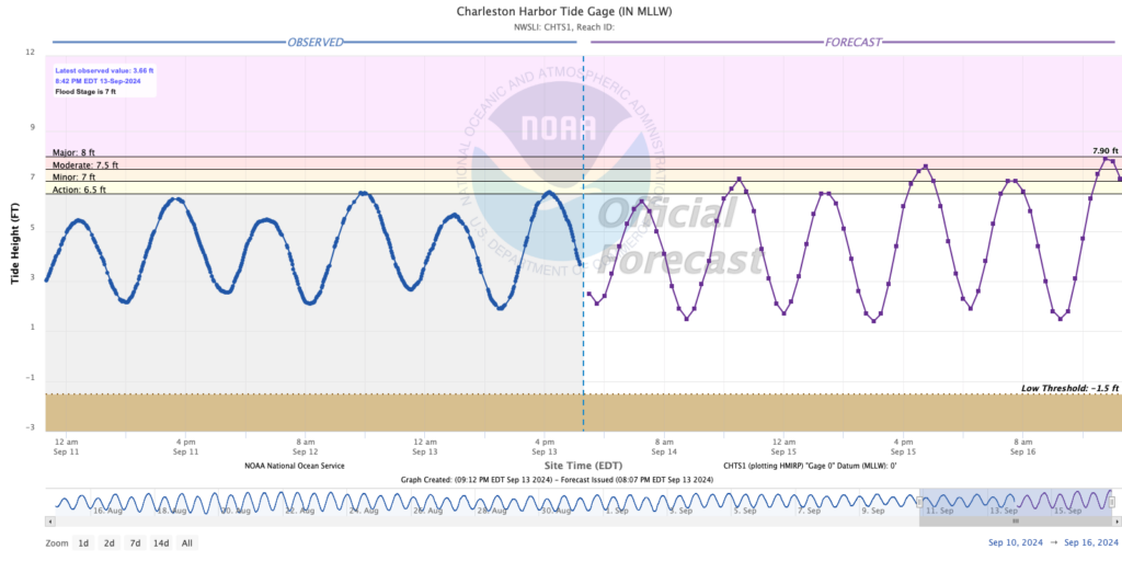
The risk for coastal flooding will increase around the evening high tides this weekend, especially on Sunday as moderate coastal flooding appears likely. On Saturday, expect water levels to reach minor flood stage (7-7.2′ MLLW) around the 5:35 PM high tide. As northeasterly winds increase and the gravitational pull of the impending full moon at perigee does the same, Sunday’s tide should run higher, with water levels peaking around 7.5-7.7′ MLLW with the 6:31 PM high tide, producing moderate salt water flooding.
Major coastal flooding is not out of the question heading into Monday evening, with even some salt water possibly impacting the morning commute, but confidence is poor in this forecast given the uncertainty around the coastal low. Stay tuned for updates.
Tropical development risk nearby
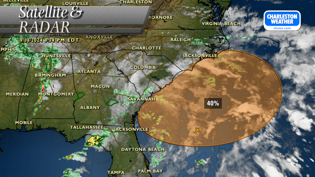
There is a possibility that the developing coastal low could acquire some tropical characteristics as it moves north and northwestward early next week. Probabilities for development have been increasing, with a 40% risk of development in the next seven days now noted by the National Hurricane Center. Where this low goes is still a bit up in the air, but the global models have been converging on a solution that brings it ashore in southeastern NC early next week. A more southerly course brings a higher risk for heavy rain and strong winds to the Lowcountry, while the more northerly course could drive drier air into the area and put a governor on any rain chances (perhaps even keeping us high and dry). While it doesn’t look like the storm will have much time to get too terribly organized into something more concerning, we’ll keep an eye on it all the same. Stay tuned for forecast updates this weekend as there will undoubtedly be some adjustments needed!
Follow my Charleston Weather updates on Mastodon, Bluesky, Instagram, Facebook, or directly in a feed reader. Do you like what you see here? Please consider supporting my independent, hype-averse weather journalism and become a supporter on Patreon for a broader look at all things #chswx!