Tuesday: Pretty nice day on the heels of PTC Eight
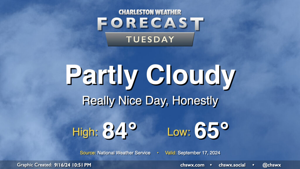
After our largely uneventful brush with Potential Tropical Cyclone Eight, we have a pretty nice weather day on tap for Tuesday as dry air wrapping around the back end of the system hangs around for one more day. We’ll start the day comfortably in the mid-60s, warming to the mid-80s in the afternoon under partly cloudy skies. Dewpoints run into the mid-to-upper 60s, so it’ll feel a little humid, but not too bad.
Rest of the work week: Brief warmup continues before cooling back off a little
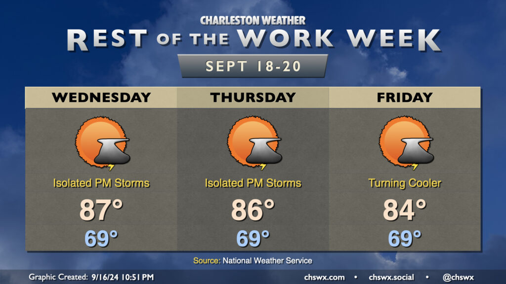
Seasonably warm conditions continue to close out the work week, with warmth peaking Wednesday before slowly trending downward as we head into the weekend. A little more moisture will be moving back into the area, and that combined with low pressure aloft will allow for a few afternoon thunderstorms each day. Lows start in the upper 60s to around 70° each day, warming to the mid-80s each afternoon. High pressure wedging southward should start to cool things off starting Friday, and the weekend should feature a return to below-normal temperatures.
Follow my Charleston Weather updates on Mastodon, Bluesky, Instagram, Facebook, or directly in a feed reader. Do you like what you see here? Please consider supporting my independent, hype-averse weather journalism and become a supporter on Patreon for a broader look at all things #chswx!