Rest of the work week: Milton gives us a brush with a gorgeous weekend to follow
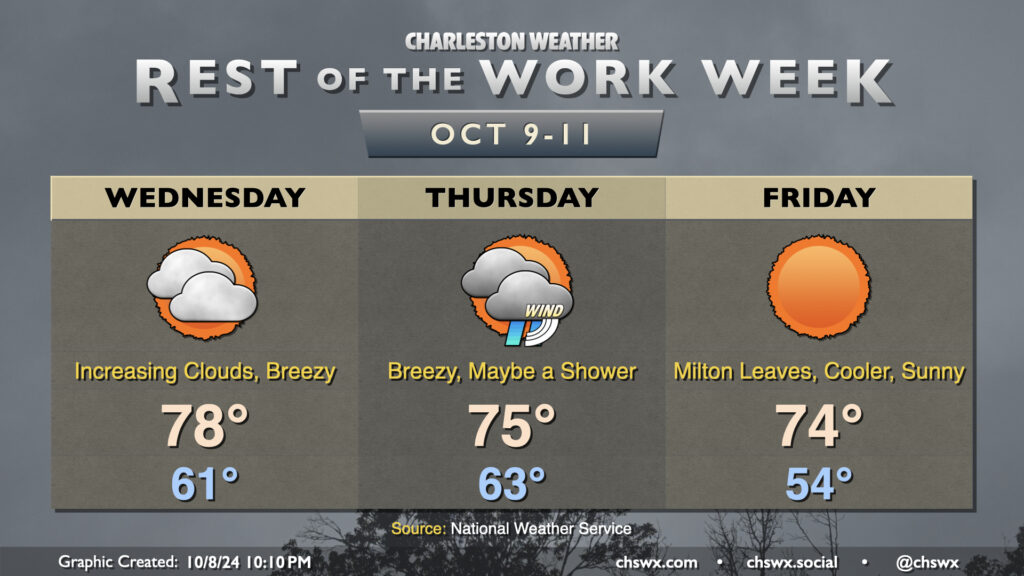
Clouds will increase on Wednesday as Hurricane Milton draws closer to landfall in Florida. We’ll see a decent northeasterly breeze during the day, but nothing unmanageable, and we’ll stay out of the rain, too. The day starts on a fairly cool note with lows in the low 60s, and we’ll warm to the upper 70s in the afternoon, tempered by the northeasterly winds and the increasing cloud cover. There will be a chance for some minor coastal flooding a couple hours around the 12:41 PM high tide, and a Coastal Flood Advisory is possible.
Milton’s impacts peak Thursday
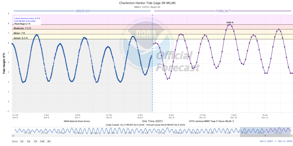
Milton’s local impacts peak on Thursday, with coastal flooding the main concern. Major coastal flooding is forecast a few hours around the 1:50 PM high tide, with water levels approaching 8′ in Charleston Harbor. These heights are where numerous roads start to close, including in Mt. Pleasant and Isle of Palms. Road issues could persist into early evening depending on how high the water level ultimately peaks, so be ready for disruptions that may impact the commute. Beach conditions will also be difficult, with high surf, dangerous rip currents, and the risk of beach erosion.
Rain-wise, models have been trending drier and drier across the area, and it’s increasingly likely that many of us will get a rain-free day in on Thursday, especially the further north and west you are. Winds will turn a little gusty, especially near the coast. Gusts 20-30 MPH are expected inland, with gusts approaching 40 MPH closer to the coast as well as in downtown Charleston. A few power outages can’t be totally discounted given the wind gusts, but long-duration power issues are not expected.
Much improved weather Friday, with lingering coastal flood concerns
Milton departs quickly late Thursday, and yields a rather beautiful and very fall-appropriate day on Friday. We start the day in the mid-50s for the first time since spring, warming to just the mid-70s under sunny skies. The only concern for Friday will be another round of minor to moderate coastal flooding with the midafternoon high tide, which may close some roads once again heading into the evening commute. We’ll keep the nice weather going into the weekend, too, as temperatures gradually moderate back to the low 80s by Sunday.
Follow my Charleston Weather updates on Mastodon, Bluesky, Instagram, Facebook, or directly in a feed reader. Do you like what you see here? Please consider supporting my independent, hype-averse weather journalism and become a supporter on Patreon for a broader look at all things #chswx!