Thursday: A brief brush with Milton, then excellent weather for the weekend
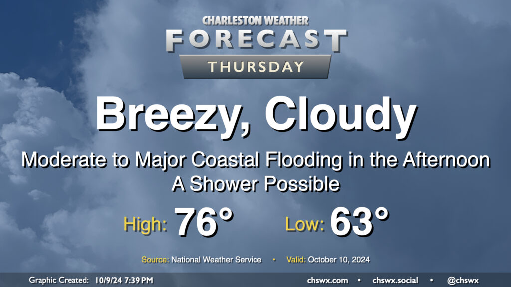
Our brush with Milton arrives on Thursday. The Tropical Storm Watch was dropped as tropical storm conditions are not expected on land (though a Tropical Storm Warning is in effect for the coastal waters). However, that doesn’t change the forecast: It’ll still be a breezy day, with a Wind Advisory in effect for the area from 6 AM to 8 PM as the gradient between high pressure to the north and Milton to the south pinches and drives gusts upwards of 40 MPH across the area. Moderate to major coastal flooding is also expected during the afternoon, with some salt water flooding possibly persisting into early evening depending on how high the tidal departure ends up being. Right now, moderate flooding is forecast as the harbor should peak at 7.8′ MLLW with high tide just before 2 PM. This will close roads in downtown Charleston and parts of Mt. Pleasant, especially around Long Point Road. Be ready to reroute in case you encounter a flooded road.
The rain threat, however, is minimal. We may see a few showers sneak in from time to time, but we will miss out on Milton’s rainfall. In fact, we can expect skies to start to clear as we get further into the afternoon and evening. Temperatures will start in the low-to-mid-60s, warming to the mid-70s in the afternoon.
Friday & the weekend: Atmospheric perfection?
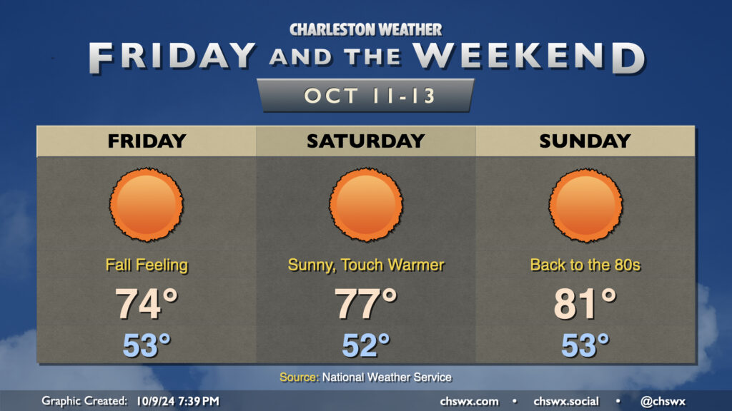
Brilliant sunshine and cooler conditions headline the post-Milton period. The first stretch of lows in the low 50s since April looks to begin on Friday as cooler and drier air continues to push into the area. We’ll top out in the mid-70s on Friday with nary a cloud to be found.
Sunny skies persist heading into the weekend, too. Highs will gradually turn warmer as the airmass moderates, but clear nights will contribute to good radiational cooling conditions, allowing lows to fall back to the low 50s each morning. It’ll be a really nice shot of fall-like weather, and I hope you get a chance to get outside and take advantage of it!
Another front should get through early next week, and it’s conceivable we could have our first highs in the 60s of the season as a result. Stay tuned…
Follow my Charleston Weather updates on Mastodon, Bluesky, Instagram, Facebook, or directly in a feed reader. Do you like what you see here? Please consider supporting my independent, hype-averse weather journalism and become a supporter on Patreon for a broader look at all things #chswx!