The week ahead: A warmer-than-normal start to November

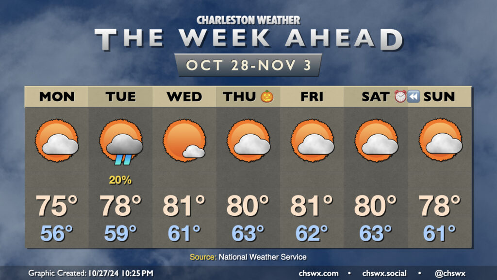
A cool wedge of high pressure knocked temperatures down into the 60s on Sunday afternoon, but we should see temperatures begin to recover starting Monday, with above-normal temperatures favored for much of the upcoming week.
Cloud cover will scour out throughout the day Monday as ridging builds back in aloft. We’ll still be under the influence of the cool wedge of high pressure, which will keep highs right around the normal mark of 75° for late October after a mid-50s start.
Rain chances remain essentially nil this week, save for Tuesday, when a coastal trough could spread some light showers ashore. Much of us should stay dry, with measurable rainfall not looking like a great bet given the antecedent dry conditions. Highs on Tuesday head a few degrees above normal, back into the upper 70s after an upper 50s start.
The weather remains dry and much warmer than normal as we close October and start November. Expect highs in the 80s each afternoon starting Wednesday through at least Saturday with seasonably mild starts in the low 60s each morning as high pressure continues to be the primary weather feature. Skies will generally be partly cloudy each day. Suffice to say, we’ve got no weather concerns for trick-or-treaters this year. A front slips by over the weekend with a slight cooldown, but moisture appears to remain at a premium, keeping rain chances virtually nil.
Finally, we fall back to Standard Time this weekend. The morning daylight will be a little more in whack with sunrises before 7am until late November, but we’re back to “dark when we leave work” season once again. We’ll go from a 6:27 PM sunset on Saturday to a 5:26 PM sunset on Sunday. We continue to lose daylight until the winter solstice on December 21.
Tropics: Yes, it’s still hurricane season, and yes, the Caribbean is acting up again

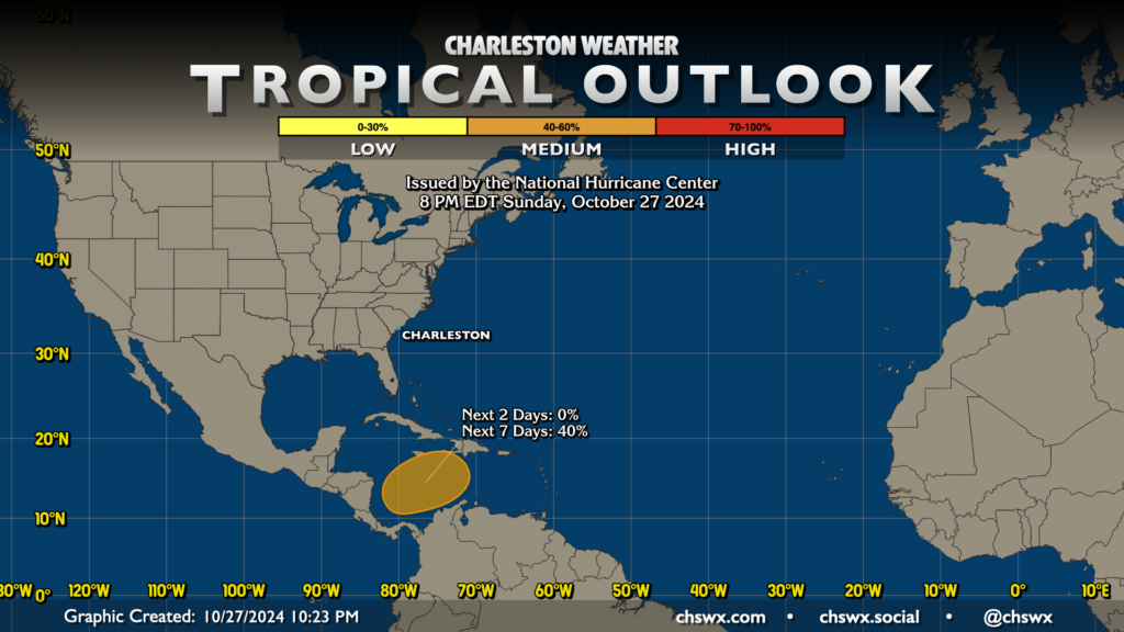
Hurricane season continues largely unabated, though there aren’t any current concerns for the Lowcountry. An area in the Caribbean has decent model support to spin something up down there in the next 7-10 days, and the National Hurricane Center is giving it 40% odds in the next week for something to develop. However, at this point, it looks incredibly unlikely that it would have impacts on the continental US. The next name on the list is Nadine. Hurricane season runs through November 30, so we’ll be continuing to keep watch until then.
Follow my Charleston Weather updates on Mastodon, Bluesky, Instagram, Facebook, or directly in a feed reader. Do you like what you see here? Please consider supporting my independent, hype-averse weather journalism and become a supporter on Patreon for a broader look at all things #chswx!