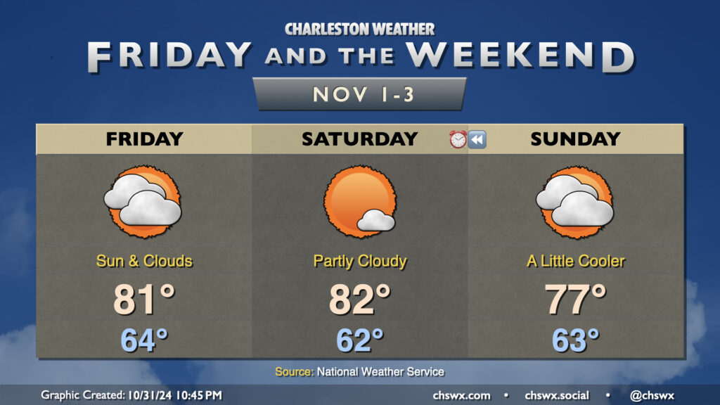
Friday & the weekend: Sun, clouds, and unseasonable warmth as drought develops

Unseasonable warmth rolls right into November as temperatures for Friday and Saturday remain upwards of 8-10° above normal for the start of the final month of hurricane season before a front cools things off slightly for Sunday. Overall, expect highs in the 80s on Friday and Saturday after starts in the low to mid-60s. A mix of sun and clouds will continue across the area, with perhaps a bit more sunshine on Saturday before a backdoor front moves by on Sunday, cooling us off a few degrees and thickening cloud cover once more.
Measurable rainfall remains extraordinarily difficult to come by; a few spots have had some sprinkles from time to time, but that’s about it. In fact, October 2024 is going to go down as the second-driest October on record with only 0.03″ of rain measured at the airport on October 4, and only traces of rain on a few occasions since then. This is second only to October 2000, when only a trace of rain was recorded that month. Records at the North Charleston climate site at the airport go back to 1937. As you can imagine, drought is developing over the area, and this week’s Drought Monitor puts much of the Lowcountry into moderate drought, while the rest of the state (except for a sliver of Lancaster and York counties) is now into Abnormally Dry conditions. We could certainly use a bit of rain, and none seems likely through at least the middle of next week.