Election Day: A few showers possible, but no washout

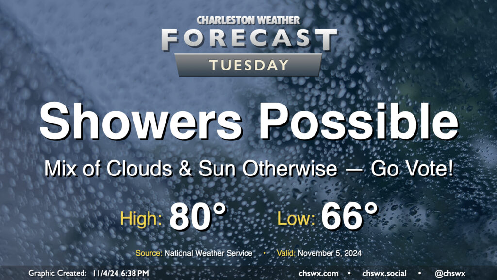
A few showers will be in the cards as we head to the polls for Election Day on Tuesday, but it won’t be a washout and should be minimally disruptive to voting. We start the day about 15° above normal with lows in the mid-60s, warming to 80° in the afternoon. We’ll see some peeks of sun from time to time as well. Go out and make your voice heard!
Rest of the work week: Staying unsettled as tropical moisture moves in

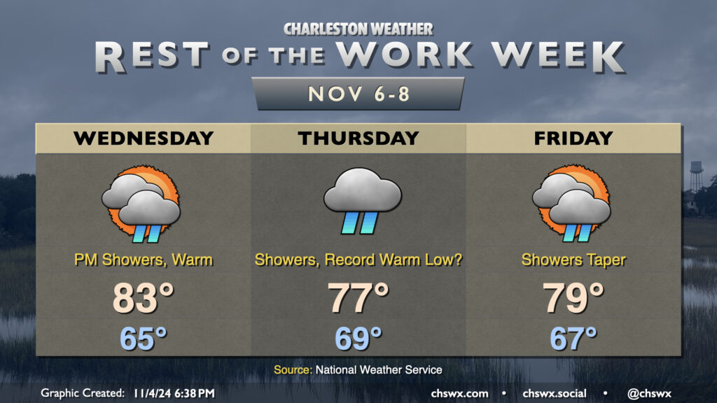
Unsettled weather will continue across the area for the second half of the work week, with more measurable rainfall expected at times starting Wednesday afternoon through Friday morning. (Our streak of 30 days without measurable rainfall at the airport ended Monday night.) This will be the result of tropical moisture from Tropical Storm Rafael working its way northward. Rafael won’t have direct impacts on our area, it looks like, but the residual moisture will certainly be helpful as it interacts with a front and produces showers across the area. The tropical air will also continue to drive rather warm temperatures for November. Expect highs in the low 80s on Wednesday before showers tamp down highs on Thursday in the upper 70s. We could reach a new record warm low on Thursday as well — the low of 69° would break the previous record warm low of 68° set in 2018 if it verifies. Temperatures continue to run rather mild on Friday as showers gradually taper off, with highs in the upper 70s to around 80° in the afternoon.
If you’re looking for more seasonable weather (e.g. something that feels more like November than whatever this is), it’s not looking great in the short term, with these temperatures expected to continue through the weekend and into next week.
Tropics (yes, really): Rafael forms, heads toward Cuba

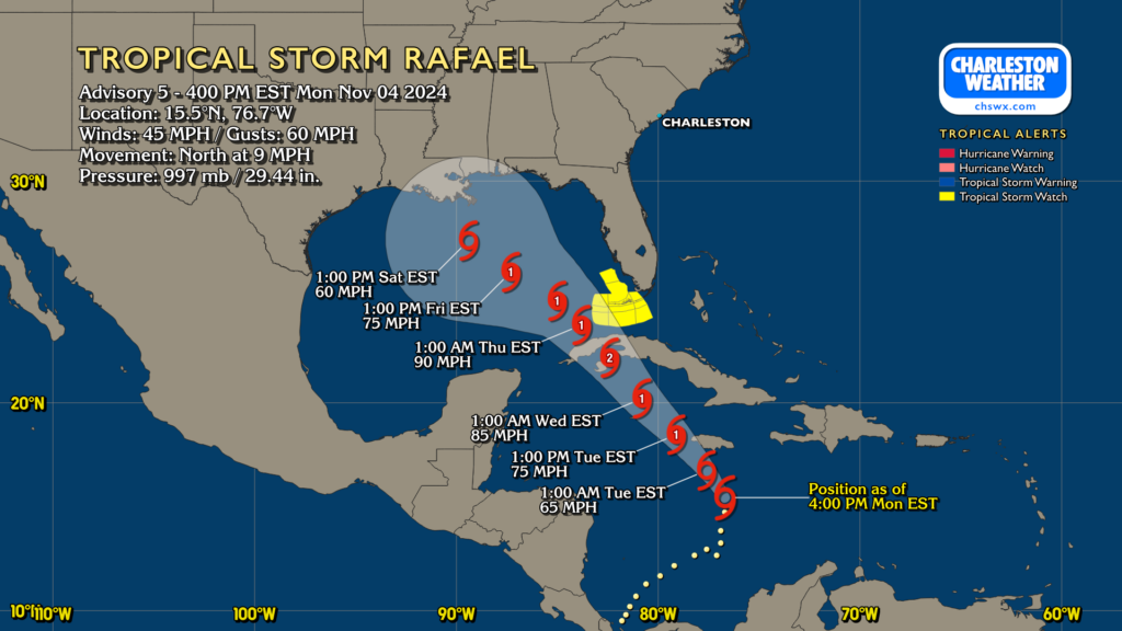
Tropical Storm Rafael developed from Potential Tropical Cyclone Eighteen today, with eyes on Cuba and a brushing of the Keys before it heads into the Gulf and starts to encounter more hostile conditions for tropical cyclone maintenance. It’s forecast to strengthen to a Cat 2 hurricane before reaching western Cuba on Wednesday. From there, it will steadily weaken to a tropical cyclone as it moves slowly northwestward through the Gulf during the second half of the week. This won’t be a direct issue for the Lowcountry, though the moisture it helps to draw northward will be a fantastic ingredient in some much-needed rainfall for the second half of the week.
Follow my Charleston Weather updates on Mastodon, Bluesky, Instagram, Facebook, or directly in a feed reader. Do you like what you see here? Please consider supporting my independent, hype-averse weather journalism and become a supporter on Patreon for a broader look at all things #chswx!