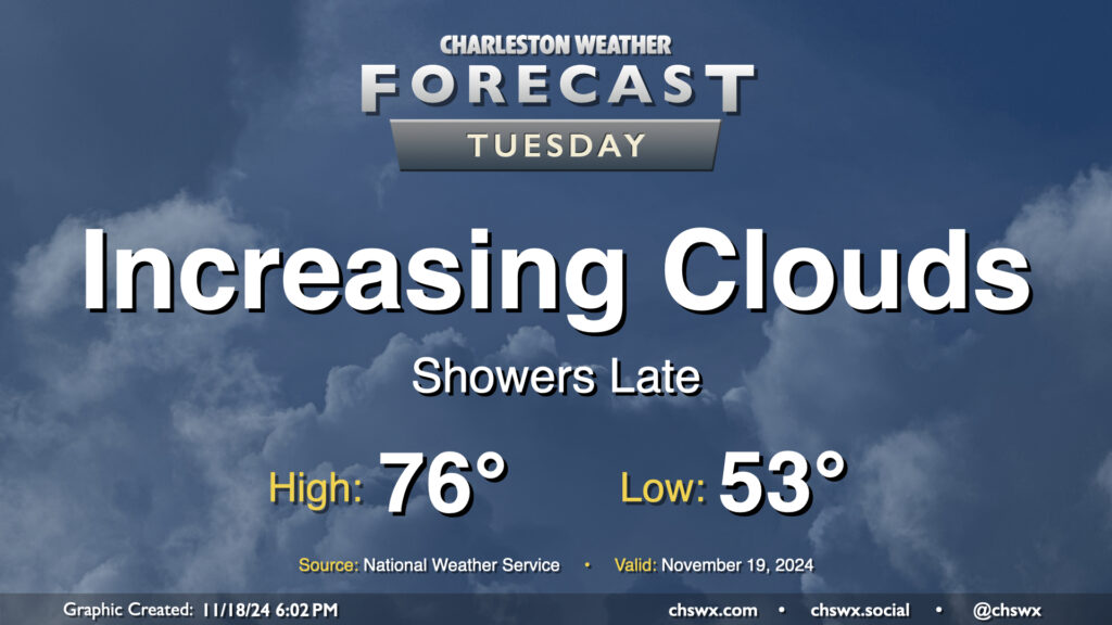
Tuesday: Clouds increase with showers late as a front approaches

We’ve got another unseasonably warm day ahead Tuesday ahead of a front that will sweep through on Wednesday. Ahead of that front, we’ll see an increase in cloud cover, and eventually some shower activity later in the afternoon into the evening and overnight. Temperatures Tuesday start in the low to mid-50s, warming to the mid-70s in the afternoon. Southwesterly winds will keep the tides at bay, thankfully, and we should fall short of the coastal flooding threshold with the mid-morning high tide, with no coastal flooding expected for the next few days at least.
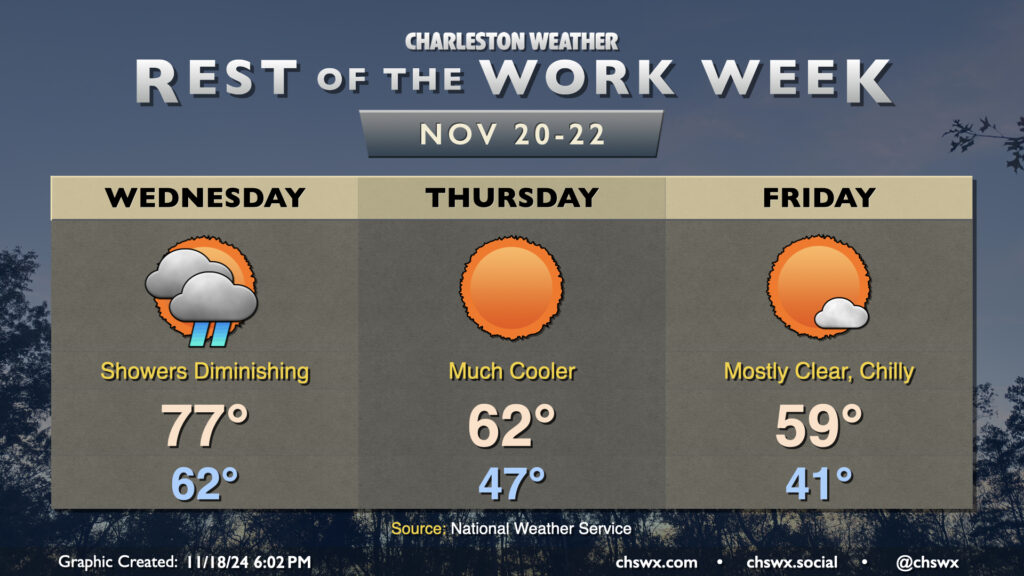
Rest of the work week: Sharp cooldown coming

We have one more warm day on Wednesday before the bottom falls out of the mercury on Thursday as much cooler and drier air works into the area behind a cold front. Wednesday will start showery, though those rains should wind down as the day goes on. Lows in the low 60s — some 15-20° warmer than normal for this point in November — will yield to highs in the upper 70s before the cooler and drier air starts rolling in late in the day/early evening.
Thursday will start in the mid-40s, but despite lots of sunshine, the ongoing cool advection will keep temperatures pinned to the low 60s at best in the afternoon. Friday will be even chillier, with lows in the low 40s giving way to highs that’ll struggle to 60° in the afternoon, once again with unfettered sunshine expected. Cooler-than-normal temperatures persist into the weekend, though the airmass will be slowly moderating with time. It remains to be seen if frost becomes an issue, but all indications are that we won’t freeze with this latest cold snap. Stay tuned!
Follow my Charleston Weather updates on Mastodon, Bluesky, Instagram, Facebook, or directly in a feed reader. Do you like what you see here? Please consider supporting my independent, hype-averse weather journalism and become a supporter on Patreon for a broader look at all things #chswx!