Rest of the work week: Showers diminish Wednesday, then turning much cooler

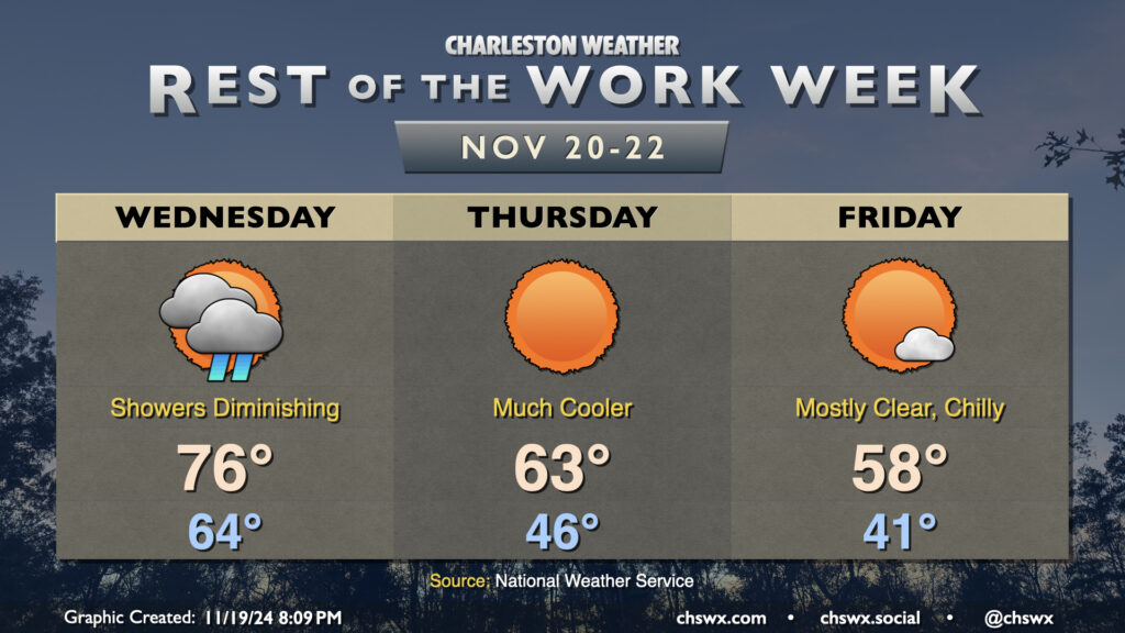
Showers will move into the area overnight and persist into a good chunk of Wednesday as a cold front moves by. We start Wednesday in the mid-60s, warming to the mid-70s in the afternoon. Showers should scour out by early evening, and from there, cooler and drier air will begin to work into the area. The airmass change will be very noticeable this go-around; we’ll start Thursday in the mid-40s, warming to the low-to-mid-60s in the afternoon at best. Friday will be even cooler, with lows in the low 40s warming to just the upper 50s in the afternoon despite full sunshine, roughly 10° below the normal temperature for November 22 and more reminiscent of normal highs for early January!
Weekend forecast: Cooler temperatures prevail

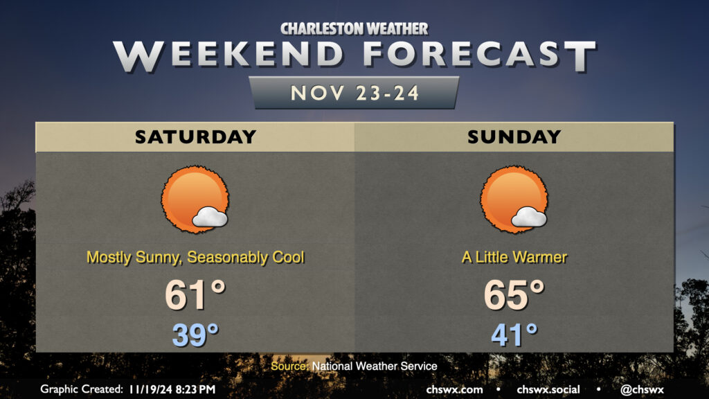
We stay on the cool side of normal for the weekend as high pressure and sunny skies prevail. We start Saturday in the upper 30s, but from here, temperatures begin to rebound. Highs on Saturday should peek back up above 60° once again, topping out in the low 60s, while we should be back into the mid-60s on Sunday as the airmass steadily moderates. All in all, not too shabby for the last weekend before Thanksgiving!
Follow my Charleston Weather updates on Mastodon, Bluesky, Instagram, Facebook, or directly in a feed reader. Do you like what you see here? Please consider supporting my independent, hype-averse weather journalism and become a supporter on Patreon for a broader look at all things #chswx!