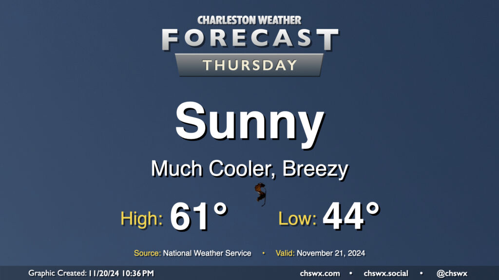
Thursday: Airmass change rolls in with much cooler air

Thursday will kick off a stretch of below-normal temperatures that will continue into the first part of the weekend before we turn a little warmer for Sunday. We start Thursday in the mid-40s, but as cooler and drier air rushes into the area, producing some gusty winds at times, high temperatures will be limited to the low 60s at best despite full sunshine. This is closer to January normals than November normals — you’ll likely want to opt for some longer sleeves as a result, at least during the morning.
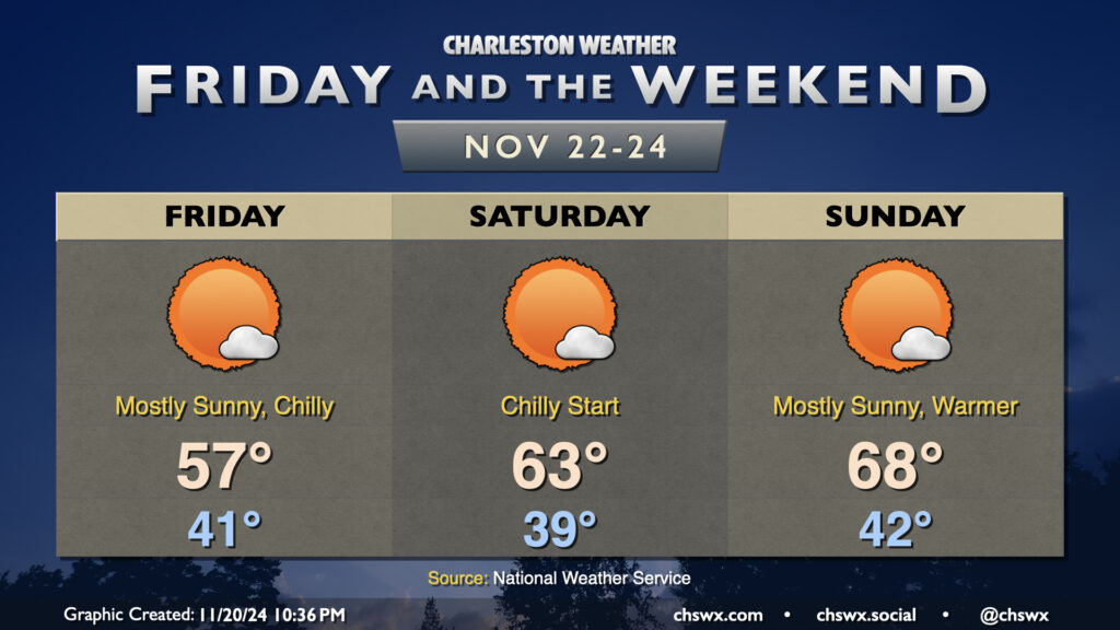
Friday & the weekend: Chill bottoms out on Friday, warming trend over the weekend

Mostly sunny but much-cooler-than-normal conditions continue on Friday. We start the day in the low 40s, warming to just the upper 50s in the afternoon as the core of the cold air works into the area. Lows on Saturday dip even further down to the upper 30s, with perhaps some frost concerns well inland and in shady areas where temperatures could turn even cooler. A warming trend will start Saturday, though, as highs rebound to the low to mid-60s in the afternoon. The airmass continues to moderate heading into Sunday, and we should have a much more seasonable day with temperatures in the low 40s yielding to the upper 60s in the afternoon as mostly sunny skies prevail. From there, slightly above-normal temperatures return to start the abbreviated Thanksgiving work week with quiet weather currently expected through at least Wednesday, though guidance for Thanksgiving and Black Friday does seem to put some rain in the area — wait and see, though.
Follow my Charleston Weather updates on Mastodon, Bluesky, Instagram, Facebook, or directly in a feed reader. Do you like what you see here? Please consider supporting my independent, hype-averse weather journalism and become a supporter on Patreon for a broader look at all things #chswx!