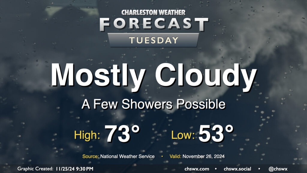
Tuesday: Weak front swings through with a few showers; bigger cooldown for Black Friday

Tuesday begins an occasionally unsettled period of weather that’ll last through early Black Friday as a series of fronts moves through the area. The first one, poised to move through Tuesday evening, won’t be terribly strong; it’ll kick up some cloud cover and maybe a few showers as well out ahead of it, but it won’t really affect the airmass all that much. We’ll start Tuesday in the low 50s, warming to the low to mid-70s in the afternoon. Dewpoints will surge back into the 60s for a brief period, but those will begin to fall by evening as the front moves by.
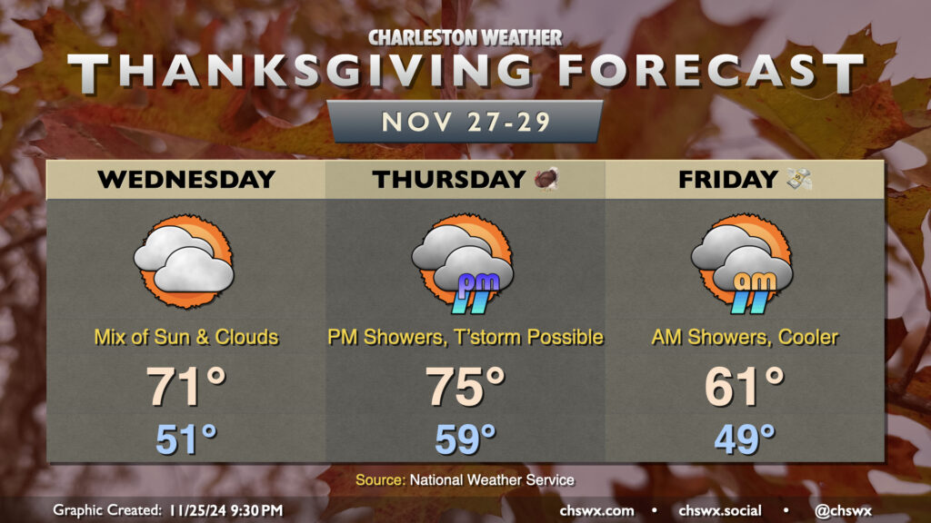
Thanksgiving forecast: A warm and unsettled Thanksgiving with a much cooler Black Friday

Wednesday will run a touch cooler behind Tuesday’s front, though we’ll still be a few degrees above normal for late November. Expect lows in the low 50s in the morning warming to the low 70s in the afternoon with a mix of sun and clouds. Thanksgiving Day will run even warmer ahead of the second cold front, with lows near 60° warming to highs in the mid-70s in the afternoon before showers start to move in. There’s some model disagreement with the exact timing of showers (and maybe even a thunderstorm), but the best chance for rain looks to be generally during the evening through Friday morning, with precipitation chances ending as the front moves by. From there, we turn quite a bit cooler — warming to just the low 60s with northwest winds blowing much cooler and drier air into the area. This will kick off a period of well-below-normal temperatures, including the potential for our first freeze as we get into the beginning of December.
Follow my Charleston Weather updates on Mastodon, Bluesky, Instagram, Facebook, or directly in a feed reader. Do you like what you see here? Please consider supporting my independent, hype-averse weather journalism and become a supporter on Patreon for a broader look at all things #chswx!