Rest of the work week: Temperature rollercoaster

We’ll add a little amplitude to the temperature rollercoaster as we get into the second half of the work week as one high pressure departs and another builds back in.
First, though, an incredibly frigid night is underway. At 9PM Tuesday, temperatures were already at or below freezing at all the airport-based weather stations in the Tri-County area, and we’re headed for the mid-20s away from the immediate coast across much of the metro for Wednesday morning. If there’s one bit of good news here, it’s that the wind will be light if not calm, so wind chill really doesn’t factor in here. Still, this will be quite a bit of time below freezing, so you’ll want to make sure you have a faucet on drip tonight as some pipe issues can’t be totally ruled out with temps starting to dip into the mid-20s.
The Arctic high pressure driving this very cold night will start to move offshore during the day Wednesday. This will allow temperatures to rebound to about the mid-50s in the afternoon under mostly sunny skies. (Contrast that with Tuesday’s observed high of merely 48°.) We’ll turn even a bit warmer on Thursday, with temperatures running much closer to normal; expect lows around 40° in the morning and low 60s in the afternoon with a mix of sun and clouds ahead of another cold front. There won’t be much moisture to work with, so that frontal passage remains dry. Then, we’re back into the icebox for Friday — expect lows in the 20s once again, with highs in the mid-to-upper 40s in the afternoon despite increasing sunshine.
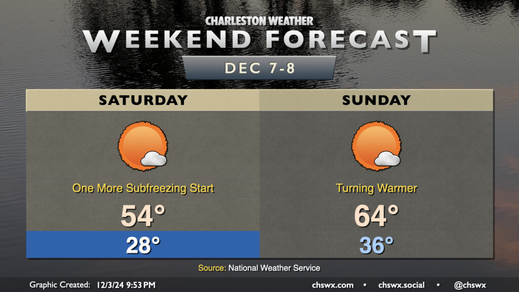
Weekend preview: Turning warmer

Peeking ahead at the weekend, we’ll find another very chilly start Saturday before temperatures start to moderate. We should stay above freezing for a little while after Saturday morning, though, as the pattern turns generally warmer with high pressure building in aloft. Expect highs in the 50s on Saturday, followed by highs in the 60s on Sunday with rain-free conditions expected. Our next rain chance looks to arrive later Monday into Tuesday.
Follow my Charleston Weather updates on Mastodon, Bluesky, Instagram, Facebook, or directly in a feed reader. Do you like what you see here? Please consider supporting my independent, hype-averse weather journalism and become a supporter on Patreon for a broader look at all things #chswx!