Friday & the weekend: Sunshine and chill
Sunny yet chilly weather will be the norm for Friday and the weekend with high pressure generally in control.
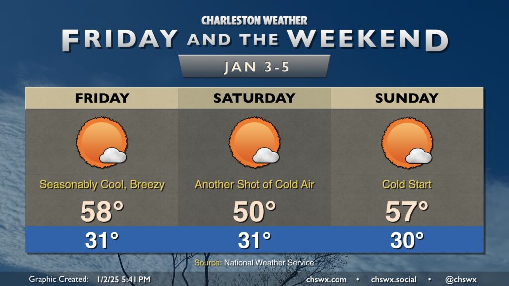
Friday looks very similar to what Thursday looked like, though with a slightly cooler start in the low 30s. Winds turn a little more westerly in advance of a reinforcing cold front, and that will send temperatures into the upper 50s in the afternoon as a result. The frontal passage will be dry, and we can generally expect mostly sunny skies on Friday given the relative dearth of moisture.
The aforementioned front gets through Friday night/early Saturday. We start the day in the low 30s once again, but only warm to about 50° in the afternoon despite nearly full sunshine given the fresh shot of cool air pushing in. Saturday is the coldest day of the weekend, though, as temperatures head back to the mid-to-upper 50s Sunday afternoon after one more subfreezing start. Bottom line for the next few days is that you’ll want pets and plants in a safe and warm place each night.
Looking ahead: Next rain chance Monday, then back to cooler-than-normal temps
Our next rain chance arrives with a storm system on Monday. This will be an icemaker from the Central Plains to the Mid-Atlantic states, but as we’ll be in the warm sector, it’ll be all rain (and maybe some thunder) here in the Lowcountry. Monday’s temperatures will run slightly on the warm side of early January normals before heading back below normal for the foreseeable future. It won’t be extreme cold, but it will be a sustained chill. Whether this pattern yields any winter weather this far south is still highly questionable at best (though the chance isn’t completely zero, either). Stay tuned…