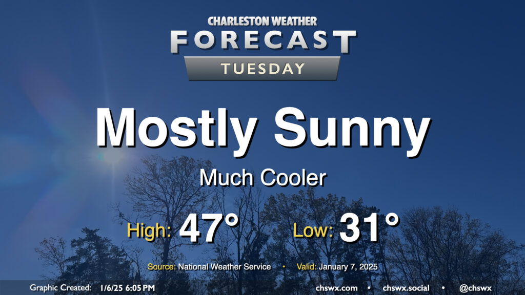
Tuesday: A stretch of cold weather begins

The weather takes a turn for the cold and stays there for the rest of the work week starting Tuesday in the wake of a front that passed through Monday evening. We’ll start Tuesday below freezing away from the coast, with lows in the low 30s expected. A bit of a breeze — though certainly not the gusty winds we saw on Monday — will keep wind chills in the low 20s Tuesday morning, so prepare accordingly for bus stops. Highs on Tuesday will struggle to the mid-to-upper 40s despite plenty of sunshine as cold and dry high pressure builds in.
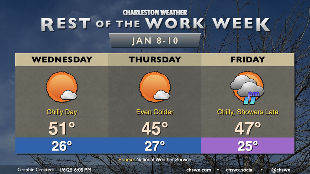
Rest of the work week: Staying much cooler than normal; next rain chance arrives Friday evening

The chill continues for the rest of the work week as well, with several frigid starts lying ahead that’ll you’ll want to make sure you have pets indoors and any sensitive plants covered up for. We start Wednesday in the mid-20s, warming to the low 50s in the afternoon ahead of a reinforcing shot of cold air that arrives for Thursday. Thursday once again starts in the mid-to-upper 20s, warming to just the mid-40s in the afternoon despite lots of sunshine.
The forecast for Friday and beyond continues to revolve around the evolution of low pressure that’ll move across the Gulf Coast before turning more northeast parallel to our coast on Saturday. The continued thinking right now is that precipitation will stay all liquid in the Charleston metro area, with any reasonable risk for wintry precipitation found generally well inland where some colder air aloft could produce a few conversational snowflakes before changing over to rain later Friday night. The low’s track along or just inland of the coast as depicted in model guidance the past few runs will bring plenty of maritime air inland, and southerly winds aloft will produce a warm nose that would spoil any snow anyway. Rain — perhaps up to an inch — will be the main factor, primarily on Saturday. I’ll let you know if things change, but right now, the risk for any winter weather impacts in our part of the world remains very, very low. (And that’s a good thing, because with that kind of warm nose aloft, we’d be talking ice!)
Follow my Charleston Weather updates on Mastodon, Bluesky, Instagram, Facebook, or directly in a feed reader. Do you like what you see here? Please consider supporting my independent, hype-averse weather journalism and become a supporter on Patreon for a broader look at all things #chswx!