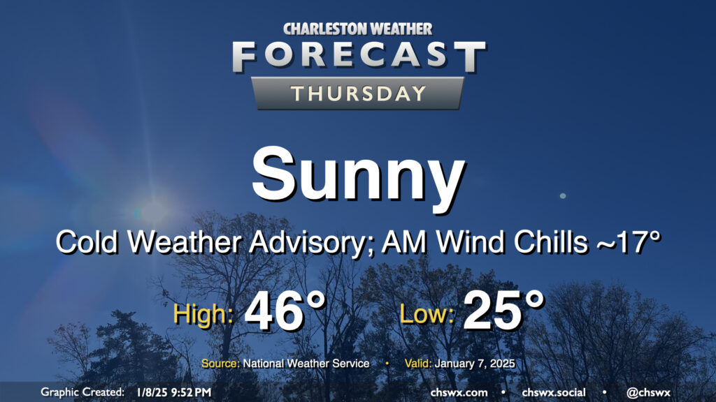
Thursday: Cold day ahead with wind chills in the teens in the morning

Thursday will be the coldest day of the week as a little reinforcing cool air moves into the area from the north. We start the day in the mid-20s, but the wind will factor in a bit more than the previous couple mornings, driving wind chills down into the teens across even the Charleston metro area. Thus, a Cold Weather Advisory will be in effect until 9am. Despite unfettered sunshine, highs will struggle to the mid-40s in the afternoon, and with the persistent north to northwest winds around 5-10 MPH, it’ll still feel like the upper 30s throughout the day. Layer up accordingly — you’ll be glad you did.
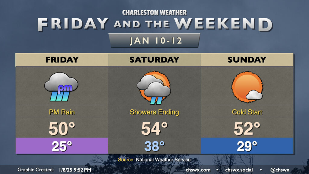
Friday & the weekend: Winter storm for points northwest, just rain here; Sunday looks good

Our eyes will turn toward the Gulf on Thursday as the storm system we’ve been talking about for a few days finally materializes, affecting us generally Friday afternoon through early Saturday afternoon. The forecast for an all-liquid event here in the Charleston metro remains on track. If there is going to be any wintry precipitation anywhere near here, it’s going to be areas near and west of I-95 where there is a tiny shot at a few snowflakes falling before changing over to rain. In the event they occur, the snowflakes would have impacts primarily on conversation and novelty, with no accumulation expected.
Expect rain to start to pick up by mid-afternoon Friday into Friday evening, with temperatures topping out around 50° or so ahead of that. We’ll see some cooling into the upper 30s overnight Friday before temperatures gradually begin warming again as low pressure moves closer to the area, drawing in more maritime air. While the daily low for Saturday will likely run in the upper 30s, I’d expect to wake up to temperatures generally in the low to mid-40s, peaking in the mid-50s by afternoon as showers gradually taper off through the morning into the early afternoon. An increasingly strong nose of warm air aloft will put the kibosh on any snowflakes well before they can sniff the surface — alas, this will be a cold rain event only.
The weather begins to improve Saturday evening as low pressure lifts away. We’re back below freezing Sunday morning, warming to the low 50s in the afternoon with just a few clouds — still much cooler than early/mid-January normals, but sunshine still helps. Cooler-than-normal temperatures with plenty of sunshine will continue into the first half of next week, too.
Follow my Charleston Weather updates on Mastodon, Bluesky, Instagram, Facebook, or directly in a feed reader. Do you like what you see here? Please consider supporting my independent, hype-averse weather journalism and become a supporter on Patreon for a broader look at all things #chswx!