Tuesday: Sunshine returns

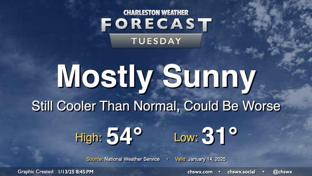
After a dreary Monday the 13th, we’ll see much more sunshine on Tuesday as high pressure rebuilds across the area. Our run of cooler-than-normal temperatures will continue, but it won’t be quite as bad; lows bottom out in the low 30s, just under freezing, and warm to the mid-50s in the afternoon. You’ll still probably need a jacket, but the bitterness of the cold will come down a notch.
Rest of the work week: Quiet weather continues for a few more days

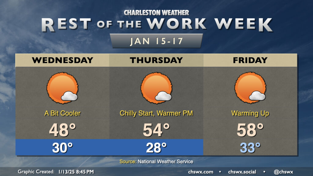
Quiet weather will continue through Friday until the next front affects the area over the weekend bringing some showers to the area. A reinforcing shot of cooler air arrives for Wednesday, and that will hold highs below 50° one more time this week despite plenty of sunshine. After an upper-20s start on Thursday, we’ll start a warming trend beginning Thursday afternoon as highs once again climb back into the mid-50s. Friday will start above or just at freezing, and we’ll warm to the upper 50s to near 60°.
Guidance continues to point to a somewhat wet weekend, particularly on Saturday, as a storm system moving through Canada sweeps a front through the area. We’ll get into the 60s for a couple days, at least, before much colder air moves back into the area next week.
Follow my Charleston Weather updates on Mastodon, Bluesky, Instagram, Facebook, or directly in a feed reader. Do you like what you see here? Please consider supporting my independent, hype-averse weather journalism and become a supporter on Patreon for a broader look at all things #chswx!