Friday & the weekend: A touch more mild but unsettled as we monitor winter weather potential next week

Friday will offer one more quiet day before an extended unsettled period kicks in starting this weekend, culminating in possible winter weather for the middle of next week.
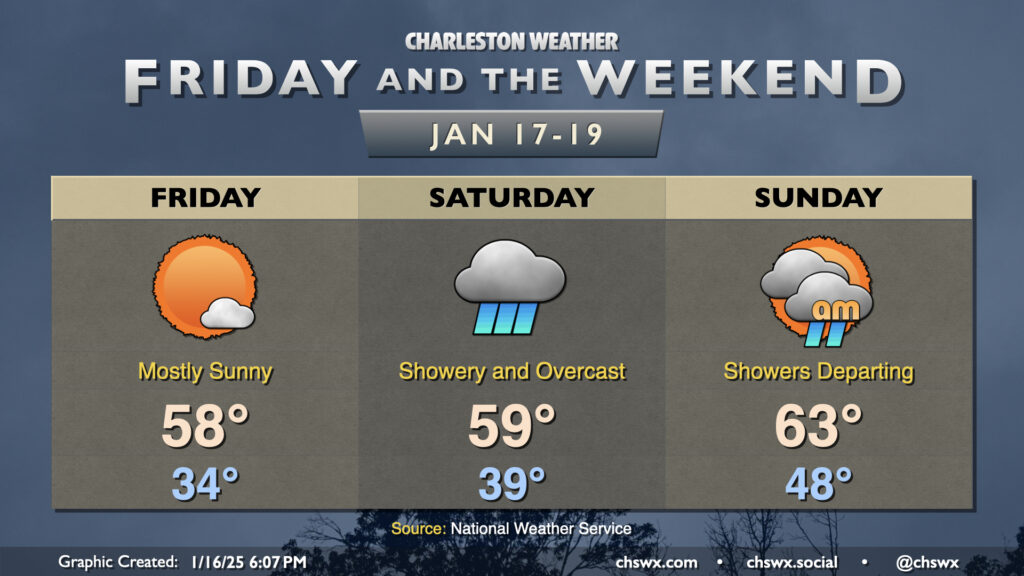
First, we start Friday generally above freezing (but not by much) with lows in the mid-30s expected. We’ll warm to the upper 50s in the afternoon with mostly sunny skies prevailing one more day before a front begins to affect the area on Saturday.

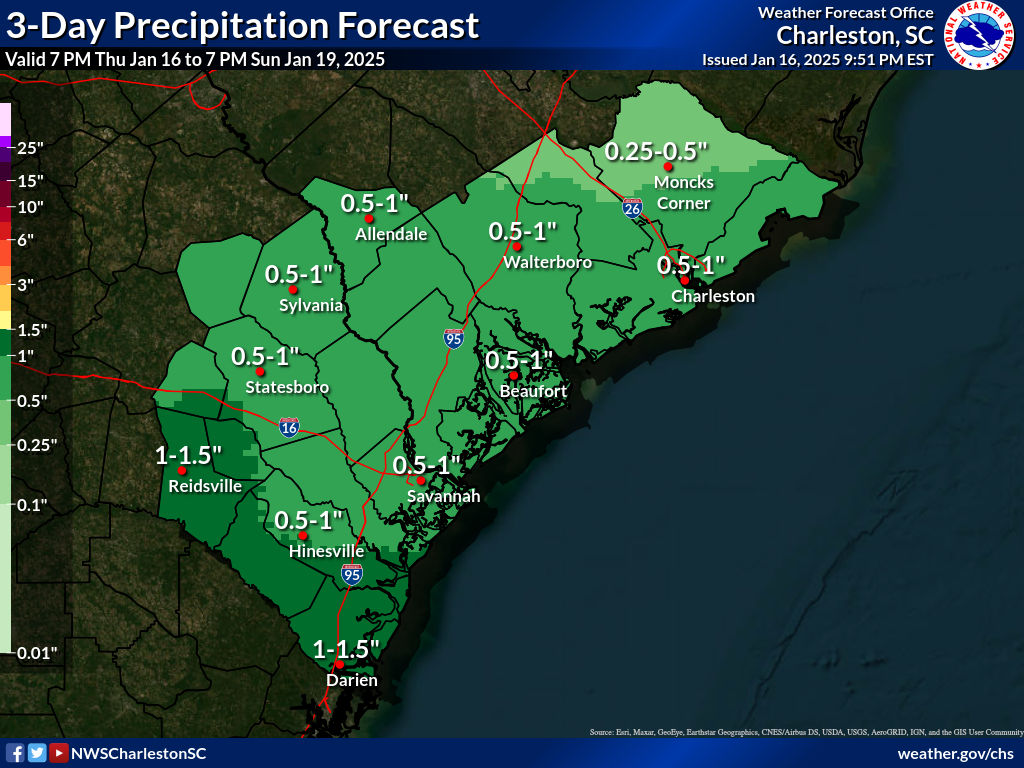
We may very well wake up to showers in the area, with on and off rain continuing through late afternoon. Guidance suggests that there’s a break in the rain that’ll move in later in the evening, so the entire day isn’t technically a wash, but we’ll be dealing with fairly widespread rain until then, it looks like. Thunder isn’t expected as the atmosphere is reasonably stable, but we could still see some locally heavy rain totals up to around 1″ or so before it’s all over. Temperatures on Saturday warm to the upper 50s to around 60° despite all the rain as we sit within a relatively warm and humid airmass for this point of the year.
Showers will be possible through early afternoon on Sunday before departing with the storm system. Temperatures Sunday will be the warmest we’ll feel for several days with low 60s expected. The sun should peek out in the afternoon, too, so a nice Sunday evening should be in order.
Storm watch: Winter weather potential trending up for next week, though not a done deal yet
Winter weather potential for the Tuesday-Thursday timeframe next week seems to be inching up. Last night’s guidance suite featured very strong high pressure that suppressed the storm track so far south we stayed dry. Now, it looks like the models are starting to back off of that idea a little. The lack of consistency doesn’t bolster confidence in any specific impacts yet. However, the idea of some sort of winter weather in the coastal corridor has generally been consistent, with the probability of minor winter weather impacts edging up into the 40-50% range across the Charleston metro up toward the Grand Strand.
It remains too soon to say exactly what impacts will take place and what precipitation types will come into play. The preponderance of the evidence suggests that as of right now, yes, in fact, snow will be involved. How involved remains to be seen, and will depend on other factors such as any warming aloft that creates a warm nose to produce freezing rain or sleet, which would impact accumulations and magnify impacts. For now, we will need to continue to monitor guidance trends over the weekend — it may be a day or two before the event before we really have a good handle on what’s to come. Stay tuned!
Follow my Charleston Weather updates on Mastodon, Bluesky, Instagram, Facebook, or directly in a feed reader. Do you like what you see here? Please consider supporting my independent, hype-averse weather journalism and become a supporter on Patreon for a broader look at all things #chswx!