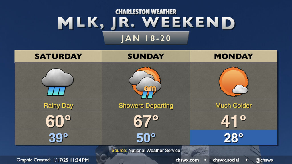
Rainy and warm conditions for the weekend, but turning much colder for MLK Day ahead of a winter storm

We have a rainy day on tap for Saturday as a complex storm system sweeps across the eastern half of the country. We’ll start the day in the upper 30s to around 40°, but warm to around 60° in the afternoon as warm, humid air moves in ahead of the storm system’s cold front. We’ll stay in the rain for a fair bit of the day after daybreak, though there will be breaks at times as well.
Showers depart early in the day on Sunday, which will be the warmest day in the forecastable future as highs top out in the mid-60s ahead of the cold front. Said front should swing through by evening, and we’ll start to see a sharp change in the airmass after that as Arctic air spills into the region from the northwest. Lows on Martin Luther King, Jr. Day bottom out in the upper 20s, heading to only the low 40s despite plenty of sunshine.
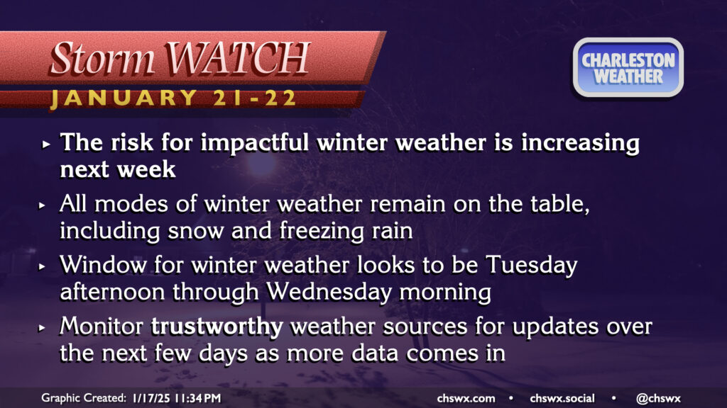
Storm watch: Winter weather chances increasing for Tuesday through Wednesday morning

The big weather story, of course, continues to be the risk for winter weather this upcoming Tuesday and Wednesday. The probability for impactful winter weather continues to tick upward as models get a little more aligned. What we still aren’t quite sold on is just exactly what type of precipitation will fall. Snow, sleet, and freezing rain all remain on the table as small changes in the thermal profile of the atmosphere will have a big impact, as is often the case in this part of the world. It’s very rare to get a “clean” snowstorm, and this event certainly looks to be no exception.
What we can be sure of is that it’ll be cold — the coldest air of the season with wind chills in the teens, in fact, prompting Cold Weather Advisories and maybe even an Extreme Cold Warning or two in a few spots — and that a storm system will develop and move nearby enough to spread some moisture our direction. And regardless of what ends up falling, any accumulations are impactful here because of the relative rarity of such weather events, so this will be something to watch closely for travel concerns Tuesday evening into Wednesday. Another round of freezing rain can’t be ruled out Thursday evening into Friday morning, either. We’ll take it one storm at a time, though! Stay tuned as forecast details continue to evolve over the next few days, especially as we start getting into range of some of the higher-resolution model guidance.
Follow my Charleston Weather updates on Mastodon, Bluesky, Instagram, Facebook, or directly in a feed reader. Do you like what you see here? Please consider supporting my independent, hype-averse weather journalism and become a supporter on Patreon for a broader look at all things #chswx!