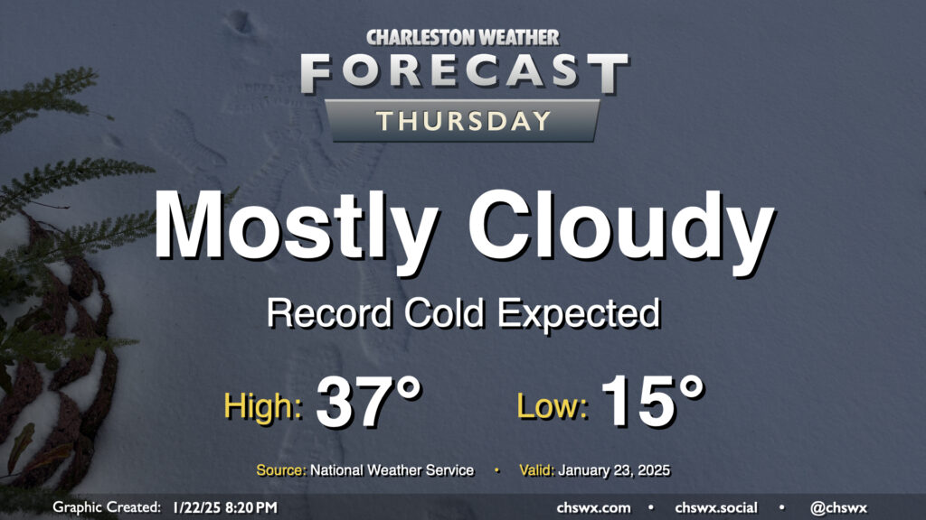
Thursday: Record cold in the morning with single-digit wind chills possible

With plenty of snowpack still on the ground, expect a very, very cold night that should set daily records on Thursday morning as lows could fall to as low as 15°. Mix in the persistent northerly wind and wind chills may fall into the single digits. If you’re headed outside tomorrow morning, be bundling up in lots of layers and be very careful for re-frozen ice on steps, sidewalks, and roads.
Additional cloud cover on Thursday isn’t gonna do us a lot of good in the melting department; highs should once again only peak in the upper 30s with mostly cloudy skies generally expected. Wind will remain a bit of a factor, and it’ll feel like the 20s for much of the daytime period.
Getting into Thursday night, I’d expect another round of refreezing and black ice concerns. If you don’t have to travel, it’s probably best to stay hunkered in one more day.
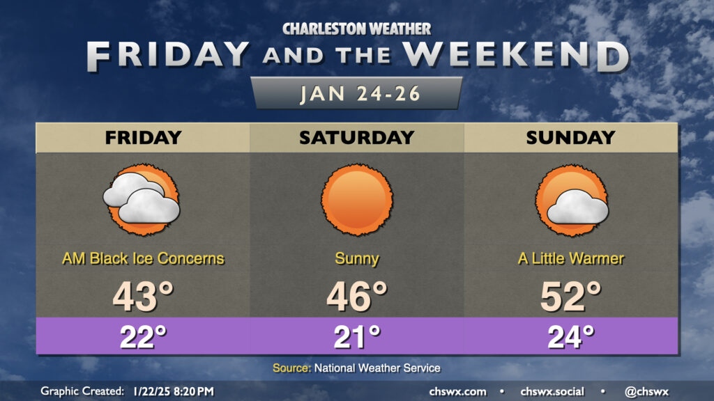
Friday & the weekend: Slow warming trend

A slow warming trend will commence on Friday heading into the weekend. Black ice will continue to be a concern at least Friday morning as refrozen slush/snow continues to pose a risk to road safety. Temperatures on Friday should warm a little more despite mostly cloudy skies for at least half of the day, with a return to the 40s expected for the first time in a few days. More sunshine arrives Saturday, but with the snowpack, we start the day once again in the low 20s, warming to the mid-40s in the afternoon. Sunday starts in the mid-20s, but we should see increased warming to the low 50s as the airmass modifies and we continue to shed snowpack. The black ice threat remains to be seen, but it is conceivable we may be dealing with it at times throughout the weekend; stay tuned.
Follow my Charleston Weather updates on Mastodon, Bluesky, Instagram, Facebook, or directly in a feed reader. Do you like what you see here? Please consider supporting my independent, hype-averse weather journalism and become a supporter on Patreon for a broader look at all things #chswx!