Thursday: A touch cooler, but still a nice late-January day
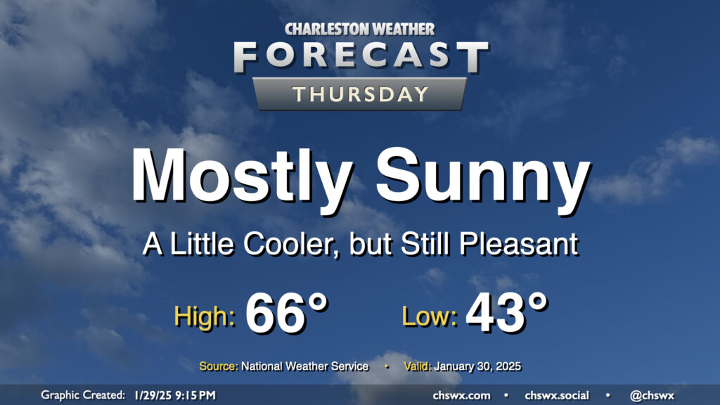
After the warmest day of 2025 so far, in which we reached 72° at the airport and 70° downtown, a dry cold front knocks our temperatures down a few degrees for Thursday, but it’ll still feel quite good outside. Expect mostly sunny skies to help low temperatures in the low-to-mid-40s warm to the mid-60s in the afternoon. An easterly wind at 10 MPH will keep things a touch on the breezy side, but otherwise, no concerns for Thursday.
Friday & the weekend: Warm but rainy end to January; looking good this weekend
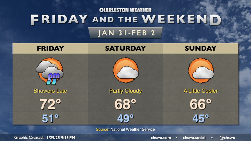
January will close on a warm and eventually rainy note as a second cold front moves by, this time with a bit more moisture to work with. We start the day in the low 50s, warming to the low to mid-70s in the afternoon courtesy of a breezy southerly wind that’ll be pumping more warm and humid air into the area ahead of the front. Showers should arrive after sunset, and should depart fairly quickly, not hanging around too far past midnight. If you’ve got Friday evening plans, keep some rain gear handy.
We’ll wake up in the upper 40s on Saturday as high pressure begins to build into the area. Highs on Saturday peak in the upper 60s under partly cloudy skies, while we’ll trend a touch cooler for Sunday as cooler high pressure continues to build in. However, temperatures will still run above normal for early February, with lows in the mid-40s yielding to highs in the mid-60s in the afternoon as we all ponder the yearly run of the Groundhog Forecast System.
Follow my Charleston Weather updates on Mastodon, Bluesky, Instagram, Facebook, or directly in a feed reader. Do you like what you see here? Please consider supporting my independent, hype-averse weather journalism and become a supporter on Patreon for a broader look at all things #chswx!