Thursday: Record warmth possible again
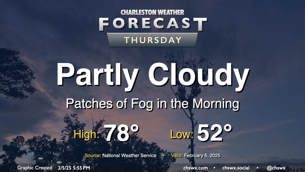
Record warmth will be possible once again Thursday as the wedge of high pressure that cooled us off on Wednesday — highs only topped out around 70° as opposed to 82° the day before — retreats northward as a warm front moves through Thursday morning. This will help disperse the cloud cover throughout the day, and temperatures should respond nicely by heading into the upper 70s. The forecast currently calls for at least tying the record high of 78° set in 2019, so we’ll see how that ends up working out.
Friday & the weekend: Abnormally warm weather continues; showers possible Friday
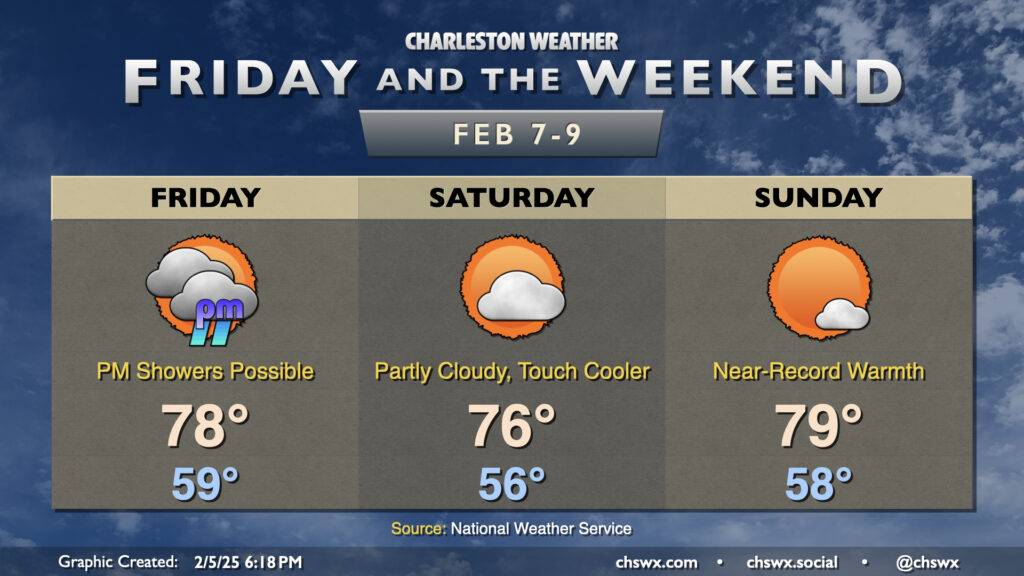
This stretch of abnormally warm weather continues through Friday and into the weekend before the weather turns a little more unsettled and cooler next week. Friday will feature lows near 60° — the normal high for February 7 is 62° — warming to the upper 70s once again in the afternoon, putting highs within spitting distance of yet another record. There will be the risk for some showers in the afternoon into the overnight as a cold front stalls nearby and some upper-level energy works through, but no washout is expected.
Saturday will run a little cooler as the aforementioned front might dip just south of the area. Otherwise, partly cloudy skies and ridging aloft continues to help send temperatures into the mid-70s in the afternoon. While off a record pace, this is still some 14° above normal for this point in February.
We should challenge one more record high on Sunday as clouds scatter out a bit more ahead of the next cold front. Lows in the upper 50s warm to the upper 70s in the afternoon, which will get close to the record of 80° set in 1949. This will be it for the extremely spring-like weather for a little bit, though. Temperatures will reset a little closer to — but still above — normal as we get into the work week next week as waves along another stalling front keep things generally unsettled.
Follow my Charleston Weather updates on Mastodon, Bluesky, Instagram, Facebook, or directly in a feed reader. Do you like what you see here? Please consider supporting my independent, hype-averse weather journalism and become a supporter on Patreon for a broader look at all things #chswx!