Tuesday: Wedge hangs on with a few showers possible
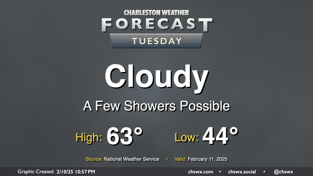
A wedge of cool high pressure hangs tough on Tuesday, bringing another gray and cool day to the area. Temperatures start in the mid-40s, warming to the low 60s in the afternoon — right around normal for this point in February. There’s going to be a risk for some showers from time to time, but an all-day rain isn’t expected.
Rest of the work week: Temperature rollercoaster heads up, then takes a dive Friday
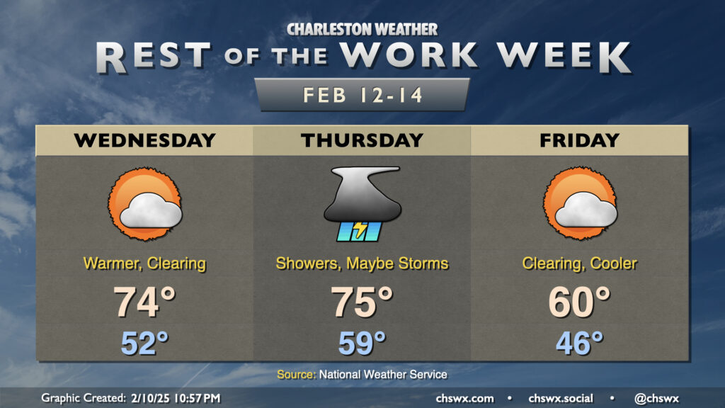
A sharp uptick in temperatures is expected for mid-week before another plunge on Friday. The wedge front will lift back northward across the area Wednesday as a warm front, breaking up the cloud cover and sending temperatures back into the mid-70s in the afternoon. This will be followed by another cold front on Thursday, which may have the juice not only for widespread showers but also the risk for a few thunderstorms as well. We’ll start Thursday near 60°, warming to the mid-70s in the afternoon along with increasing shower and thunderstorm chances. This front sweeps through overnight Thursday, and by Friday morning we’re back in the mid-40s, with cooler and drier air keeping highs capped to around 60° under decreasingly cloudy skies.
Follow my Charleston Weather updates on Mastodon, Bluesky, Instagram, Facebook, or directly in a feed reader. Do you like what you see here? Please consider supporting my independent, hype-averse weather journalism and become a supporter on Patreon for a broader look at all things #chswx!