Thursday: A line of showers and thunderstorms moves through; cooler air to follow
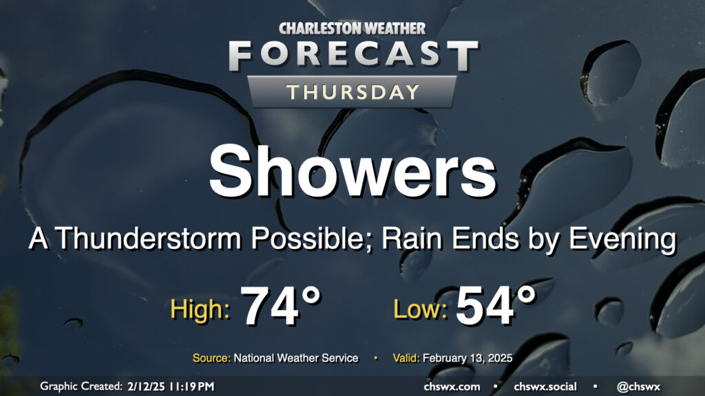
A warm front will lift north of the area overnight, scouring out some dense fog and sending much warmer and more humid air into the area ahead of an approaching cold front. Within the warm sector, we’ll start in the mid-50s, warming to the mid-70s early on before a line of showers and maybe a few thunderstorms approaches the area, generally affecting the metro between 10am-4pm. Severe weather is unlikely this far north where instability is a bit more meager, but a rumble of thunder or two with a strong wind gust is still not totally out of the question. You won’t need the rain gear all day, though, as storms should be offshore by evening with the front following thereafter.
Friday & the weekend: Chilly on Friday, then back to warm and unsettled weather over the weekend
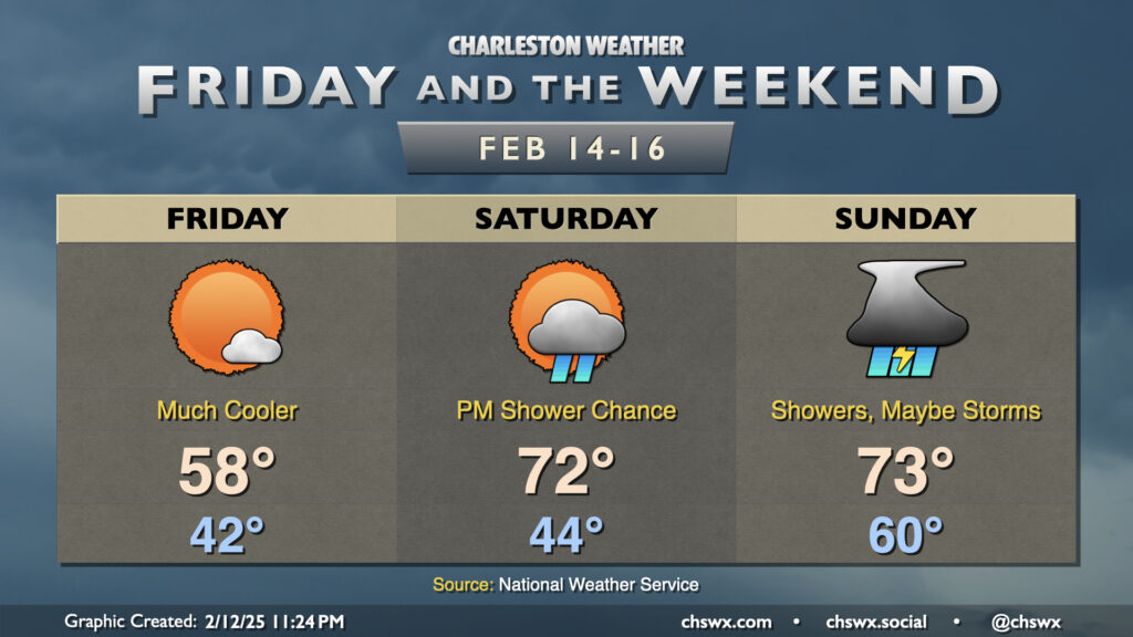
Much cooler air will filter into the area behind Thursday’s cold front, sending temperatures to the low 40s in the morning but only warming to the mid-to-upper 50s in the afternoon despite largely unfettered sunshine. The chill doesn’t last terribly long, though, as a warm front lifts north of the area Saturday, warm-sectoring us again ahead of another cold front that will bring us a few showers on Saturday and more widespread showers and thunderstorms on Sunday. 70s will be expected each afternoon this weekend, with a low around 60° expected on Sunday ahead of the main line of storms. It remains to be seen if a severe weather threat can take shape Sunday; we’ll be watching instability trends as the shear looks like it’ll be there, as is often the case in the cool season. We’ll keep an eye on things, but for now, just plan for some indoor activities especially Sunday afternoon.
Follow my Charleston Weather updates on Mastodon, Bluesky, Instagram, Facebook, or directly in a feed reader. Do you like what you see here? Please consider supporting my independent, hype-averse weather journalism and become a supporter on Patreon for a broader look at all things #chswx!