Thursday: Much colder as clouds depart
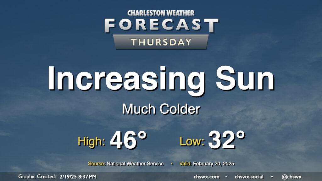
Clouds will thin out throughout the day Thursday as colder and drier air pours into the area from the northwest. We’ll start the day around freezing, warming to just the mid-40s in the afternoon despite the increasingly sunny skies. The last time we had a high temperature this cold was January 24, when the high was only 47° courtesy of 2″ of snow still on the ground from the 1/22 snowstorm. (The record cold high temperature of 39°, set in 2015, will remain intact, thankfully.)
Friday & the weekend: Very chilly Friday, then temperatures turn back upward as generally quiet weather prevails
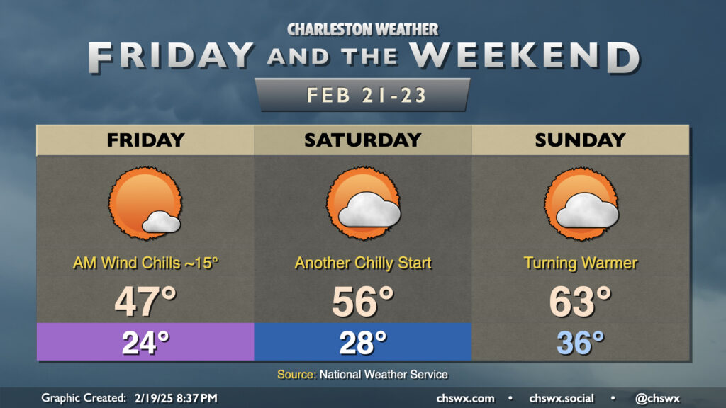
Friday will be a bone-chiller of a day, especially in the morning, as persistent northerly winds combine with lows in the mid-20s to drive wind chills to the mid-teens in the morning. You’ll want to make sure you and your progeny are bundled up appropriately for work and school on Friday morning, that’s for sure — lots and lots of layers. Temperatures will struggle to the mid-to-upper 40s in the afternoon despite plenty of sunshine.
A few more clouds punctuate the skies over the weekend, but we look to largely stay rain-free. Saturday starts in the upper 20s once again, but we’ll get a little more temperature recovery than we did on Friday with highs topping out in the mid-50s, nearly 10° warmer than the previous day. Sunday stays above freezing throughout, with lows in the mid-30s heading to the low 60s in the afternoon, once again with a mix of sun and clouds. This leads into a seasonably warm start to the last week of February as temperatures reach the 70s again by Tuesday.
Follow my Charleston Weather updates on Mastodon, Bluesky, Instagram, Facebook, or directly in a feed reader. Do you like what you see here? Please consider supporting my independent, hype-averse weather journalism and become a supporter on Patreon for a broader look at all things #chswx!