Tuesday: More sunshine and much warmer
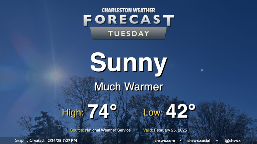
A cloudy and cool Monday will give way to a much sunnier and warmer Tuesday. After starting in the low 40s, expect highs to peak in the mid-70s in the afternoon, several degrees warmer than the 68° we peaked at on Monday. This is well above normal for the end of February; the normal high for February 25 is 66°.
Rest of the work week: Warm through Thursday, cooling off Friday
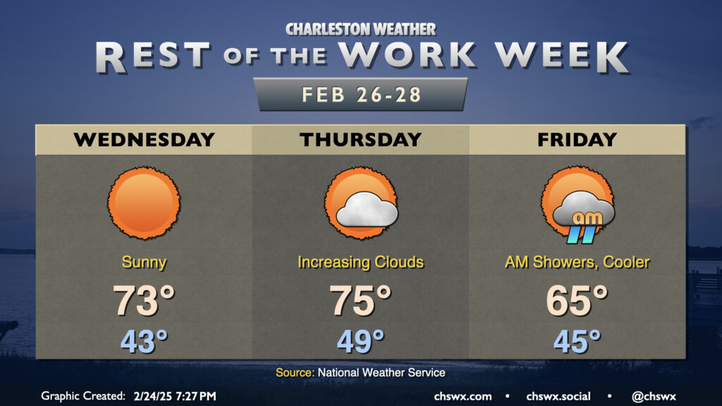
We’ll stay sunny and warm on Wednesday as high pressure builds overhead briefly. Expect another day with lows in the low 40s warming to the low to mid-70s in the afternoon with unfettered sunshine. We’ll start to see an uptick in cloud cover on Thursday as a cold front approaches, but southwesterly winds ahead of said front will help drive temperatures a few degrees warmer than Wednesday. Overall, expect lows in the upper 40s to around 50° in the morning to warm to the mid-70s in the afternoon, perhaps a couple degrees warmer than Wednesday despite the increase in cloud cover. We should get much of the day in rain-free, but some late-evening showers aren’t totally out of the question, either.
Shower chances peak overnight Thursday into early Friday morning. They’ll come to an end after the front pushes through, which will yield a cooler day as the airmass chills out a bit. Lows in the mid-40s will just warm to about the mid-60s on Friday, closer to normal if not slightly on the cool side of it as we close out February and climatological winter.
Follow my Charleston Weather updates on Mastodon, Bluesky, Instagram, Facebook, or directly in a feed reader. Do you like what you see here? Please consider supporting my independent, hype-averse weather journalism and become a supporter on Patreon for a broader look at all things #chswx!