Tuesday: Turning warmer, but a little cloudier and breezier ahead of Wednesday’s front
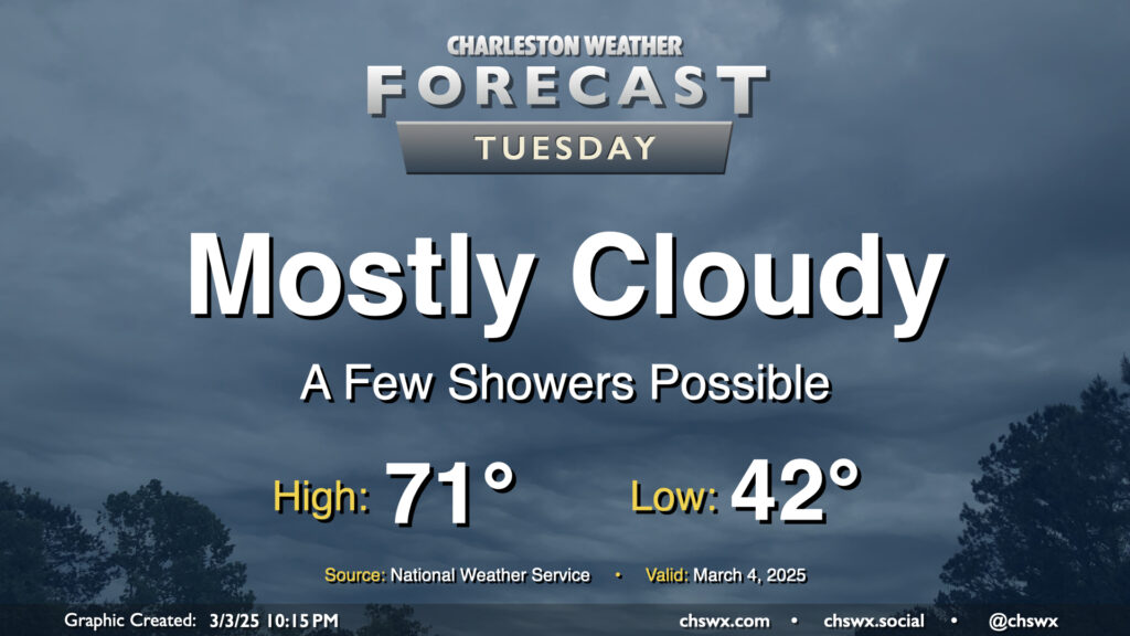
After a sunny but chilly Monday, temperatures begin to warm up ahead of Wednesday’s cold front as we get into Tuesday. We’ll also see cloud cover begin to thicken up as well, and there could even be a few showers at times as Atlantic moisture builds in. We start the day in the low 40s — about 10° warmer than the frosty start we felt on Monday morning — and head back to the low 70s in the afternoon. It’s going to be breezy as well — winds will generally run between 10-15 MPH, but could gust to 20-25 MPH at times.
Rest of the work week: Unsettled Wednesday, cooling off Thursday and Friday
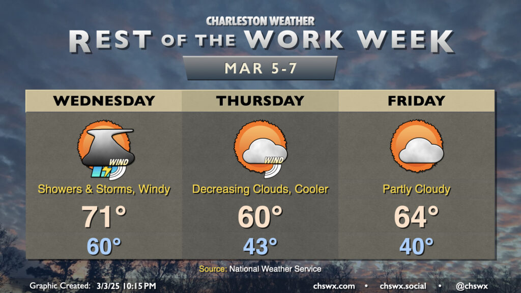
Wednesday will be the most active weather day this week as a line of showers and thunderstorms pushes through the area during the late morning hours. Instability looks like it will be pretty meager, but there will be plenty of shear, so any storms that can get going will be capable of producing some sporadic damaging wind gusts. The shear is sufficient for even a spin-up tornado on the leading edge of the line, but with the lack of instability, it will be very unlikely that we’d see anything like that. Still, it’ll be a windy day across the area with gusts outside of thunderstorms in the 30-35 MPH range, so be ready for possible power outages and difficult driving conditions on bridges and overpasses. The good news? We’re going to get some much-needed rain, however briefly it may be around. Temperatures Wednesday start around 60°, warming to the low 70s before storms roll by.
The front cools us off nicely for Thursday. Westerly winds will be gusty at times, so the low of 43° could feel more like the mid-30s in the morning. We’ll struggle to warm to about 60° in the afternoon with the cold air behind the front despite increasingly sunny skies. Winds calm down Thursday night, and should be generally light on Friday. We start the day a little cooler — around 40°, and maybe cool enough for some frost formation inland — and warm to the mid-60s in the afternoon under partly (but increasingly) cloudy skies, a few degrees below normal for March 7.
Follow my Charleston Weather updates on Mastodon, Bluesky, Instagram, Facebook, or directly in a feed reader. Do you like what you see here? Please consider supporting my independent, hype-averse weather journalism and become a supporter on Patreon for a broader look at all things #chswx!