Wednesday: Windy day with mid-morning to midday severe potential
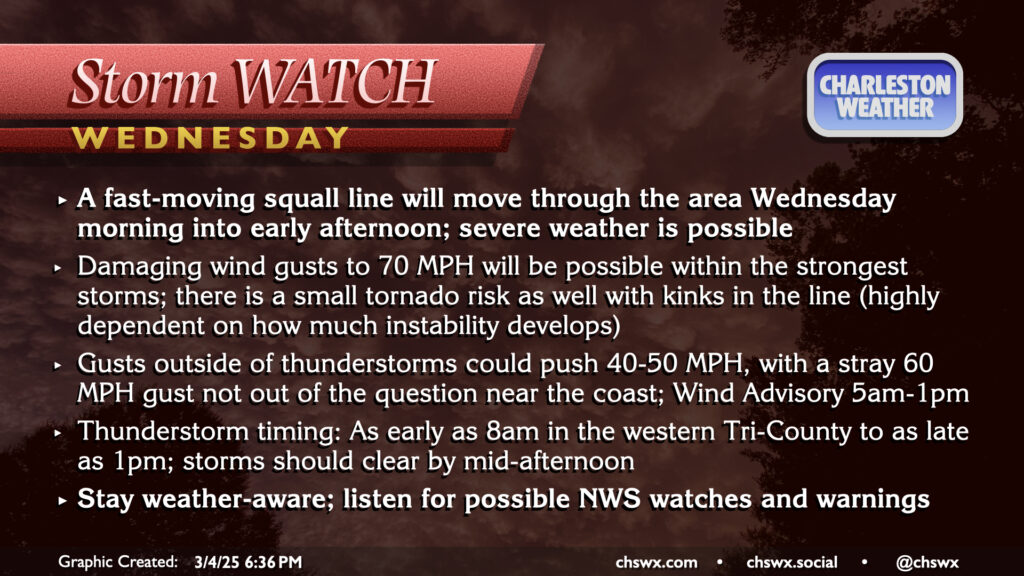
The first solid severe weather threat of the spring arrives tomorrow morning as a potent storm system drags a cold front across the Southeast.
Ahead of that front, rather windy conditions will develop, especially after sunrise. Gusts 40-50 MPH will be very possible, and there is even the outside risk of gusts pushing 60 MPH near the coast. A Wind Advisory will go into effect at 5AM, and should last through about 1PM, which represents the expected window of the gustiest winds. We should still see gusty winds in the evening in the wake of the front, though, but it’s unclear if they’ll rise to the level of a Wind Advisory (40 MPH).
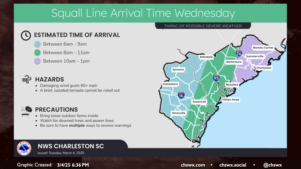
The prefrontal squall line will be marching eastward overnight and should be getting reasonably close to the Lowcountry by daybreak. We should see temperatures head into the low 70s ahead of the line, and this may be enough to develop some instability across the area. The degree of instability is still a little in question, though, and that’s what makes this type of forecast typically difficult to nail down. However, the expectation is that there should be enough juice for at least a few isolated damaging wind events. Gusts 60-70 MPH will be possible within severe thunderstorms, and an isolated gust above 70 MPH isn’t totally out of the question, either. We will also need to watch the leading edge of the line closely for the potential for brief tornadoes to develop. Overall, we can expect the timing for the squall line to be around as early as 8AM near I-95 to as late as 1PM near the coast. Expect a weather watch to be posted early in the day, and keep an ear out for possible warnings.
The line of storms will bring us some rain, but it won’t amount to too terribly much — just a quarter to half-inch of rain is expected owing to the fast storm motions. Any rain helps, but this won’t be a drought-buster. All of this should get off the coast by mid-to-late afternoon as the front clears the area.
Rest of the work week: Turning cooler
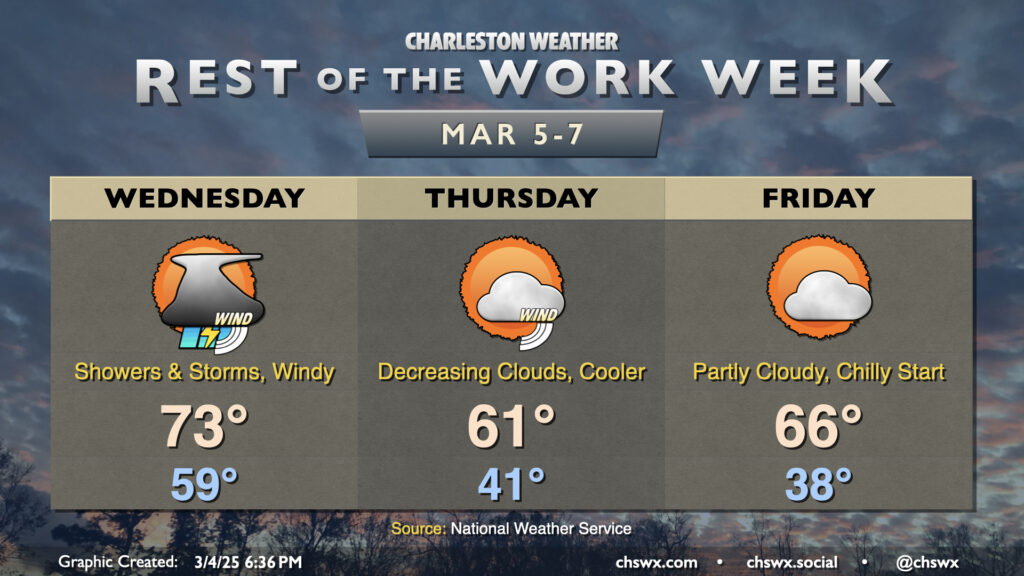
Once we get through our stormy Wednesday, we turn cooler for Thursday. Clouds will be decreasing, but it’ll still be a bit windy as the cooler air advects into the area behind the front. Temperatures start in the low 40s, only warming to the low 60s in the afternoon — about 6° or so below normal for March 6. Friday morning looks even cooler (but less windy) as lows bottom out in the upper 30s in the metro. It remains to be seen whether there will be frost and freeze concerns further into Charleston proper, but inland areas may very well need to protect plants and pets Thursday night into Friday morning. We do start to see temperatures rebound to a spitting distance of normal Friday afternoon, though, as highs top out in the mid-60s.
Temperatures briefly head above normal on Saturday — think mid-70s — before another front brings showers overnight into Sunday morning, knocking Sunday’s highs back to the low 60s in the process. From there, we look to take another upswing on the temperature rollercoaster, getting to the mid-60s on Monday and perhaps back in the low 70s on Tuesday.
Follow my Charleston Weather updates on Mastodon, Bluesky, Instagram, Facebook, or directly in a feed reader. Do you like what you see here? Please consider supporting my independent, hype-averse weather journalism and become a supporter on Patreon for a broader look at all things #chswx!