Thursday: A few more clouds, but still warm
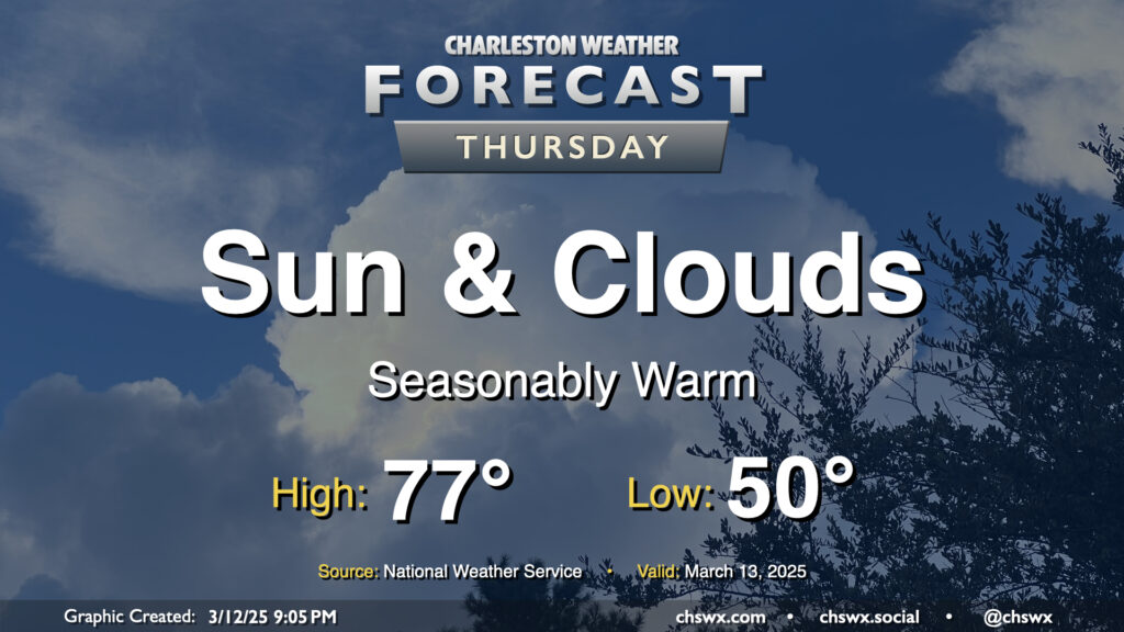
We’ll see a few more clouds on Thursday as a shortwave trough swings through aloft, but other than a slight downtick in temperatures compared to Wednesday’s highs in the low 80s, we’ll remain seasonably warm as surface high pressure remains anchored in the Atlantic for one more day. We’ll keep an eye on the moisture profiles to make sure that no showers try to overachieve with the upper-level energy moving by, but the expectation is that it’ll just be too dry for much more than the enhanced cloud cover.
Friday & the weekend: Warmth continues ahead of a Sunday storm system
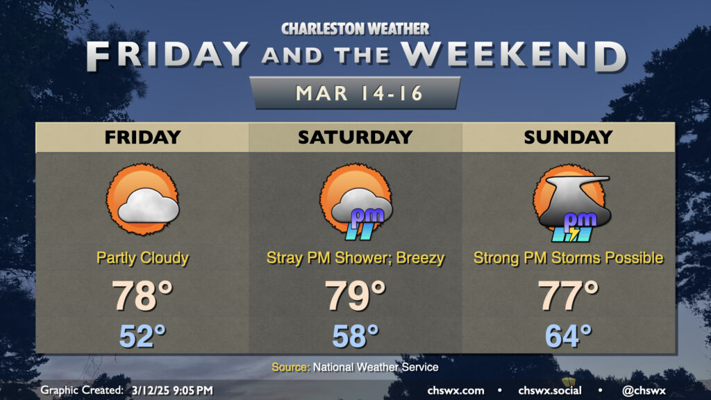
We’ll stay warm as we head into Friday and the weekend ahead of a storm system that will arrive on Sunday, bringing our next substantial rain chance — and another possible severe storm risk as well. High pressure at the surface and aloft on Friday will make for a warm and partly cloudy to mostly sunny day. Expect highs to head back into the upper 70s in the afternoon after starting the day in the low 50s.
The breeze starts to pick up a bit Saturday as the pressure gradient begins to tighten ahead of the incoming storm system, with gusts pushing 20 MPH at times. Temperatures will still run quite warm — expect lows in the upper 50s to near 60°, while highs peak in the upper 70s once again. We’ll see an uptick in cloud cover especially later in the day, and there’s even a shot at a stray shower or two with a little enhanced coastal convergence as we head into the evening. However, much of us should remain rain-free Saturday; it’ll certainly be the day to get out and about for any St. Patrick’s revelry you’d rather not do on Monday.
Sunday remains the day to watch for the potential for strong to severe thunderstorms. We should start the day rain-free, but from there, models depict a squall line reaching the area in the afternoon and evening hours ahead of a strong cold front. Wind shear will be plentiful, and non-thunderstorm gusts could still peak well into the 30+ MPH range. We could see modest instability in place, and if that comes to fruition, strong to severe thunderstorms will be possible within the line. Damaging wind gusts will be the main concern, though low-level winds will be strong and turning with height, which may support an isolated tornado or two on the leading edge of the line as well. We’ll see how this shakes out, but for now, let’s just keep an eye on how Sunday’s forecast evolves. Stay tuned…
Follow my Charleston Weather updates on Mastodon, Bluesky, Instagram, Facebook, or directly in a feed reader. Do you like what you see here? Please consider supporting my independent, hype-averse weather journalism and become a supporter on Patreon for a broader look at all things #chswx!