Thursday: Showers return with a cold frontal passage
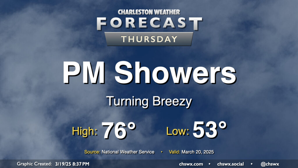
Showers return to the forecast on Thursday as a cold front moves into the area. We’ll get off to a comfortable start, with temperatures in the low-to-mid-50s to start the day. The front should show up later in the day, and we’ll get some rain-free time in, warming to the mid-70s before showers arrive. Model guidance brings the rain into the area by mid-afternoon and gets it through the area about 2-3 hours later. The rain won’t amount to much; about a quarter-inch at most. It’ll turn breezy as the front moves by, with gusts 20-30 MPH possible. Once it’s through, we’ll start to cool down heading into the overnight.
Friday & the weekend: A seasonably cool Friday, then a really pleasant weekend
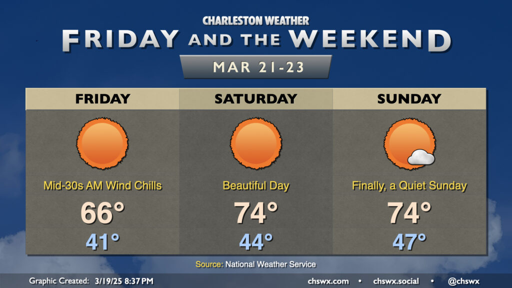
We’ve got a much cooler start expected on Friday in the wake of the front. Air temperatures fall to around 40°, but the northwest breeze will make it feel closer to the mid-30s. (No frost concerns, though.) Cool air continues to build in throughout the day, keeping highs pinned to the mid-60s despite full sunshine.
From there, high pressure moving overhead tees up a beautiful weekend of weather. We start Saturday in the mid-40s, warming to the low-to-mid-70s in the afternoon with largely cloudless skies expected once again. A couple more clouds get into the mix on Sunday, but that’s the only blemish (if you could call it that) on what will otherwise be a really fine Spring day in the Lowcountry. I hope you can take advantage!
Follow my Charleston Weather updates on Mastodon, Bluesky, Instagram, Facebook, or directly in a feed reader. Do you like what you see here? Please consider supporting my independent, hype-averse weather journalism and become a supporter on Patreon for a broader look at all things #chswx!