Tuesday: More sunshine, still comfortably warm
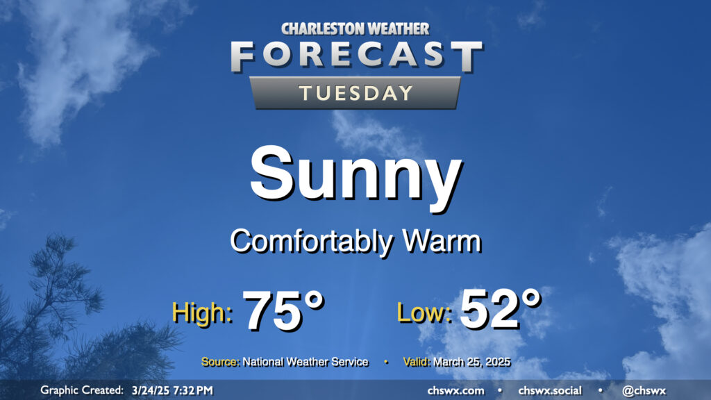
After a front swings through late Monday, quiet weather takes root for the rest of the week starting Tuesday. And what a nice day of weather Tuesday will bring: after starting in the low 50s, temperatures warm into the mid-70s in the afternoon with plenty of sunshine and low humidity. Once again, a shame the pollen is such a thing this time of year, because it’s looking like a beautiful day to get out and about where you have opportunities to do so.
Rest of the work week: Pleasant weather continues
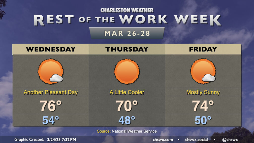
A dry cold front gets through Tuesday night, with another round of high pressure building into the area in its wake for Wednesday. It won’t feel much cooler, though, as the high’s position over the Midwest puts us within northwest flow, which downslopes from the mountains, causing compressional heating. This yields highs in the mid-70s once again with just a stray cloud or two. High pressure then moves more to our north for Thursday, and wind directions swing around to the northeast, shutting the downsloping off and ushering in a bit cooler air from the Atlantic. We start Thursday in the upper 40s, warming to about 70° in the afternoon with full sunshine. High pressure shifts offshore for Friday, allowing temperatures to rebound back to the mid-70s in the afternoon with a few more clouds as wind directions turn a little more southerly on the backside of the high. I know it’s the work/school week for many of us (though Dorchester has spring break this week), but I still hope you can find ways to get some outside time in! (Perhaps with a mask if you’re sensitive to the pollen!)
Follow my Charleston Weather updates on Mastodon, Bluesky, Instagram, Facebook, or directly in a feed reader. Do you like what you see here? Please consider supporting my independent, hype-averse weather journalism and become a supporter on Patreon for a broader look at all things #chswx!