Thursday: More pleasant weather
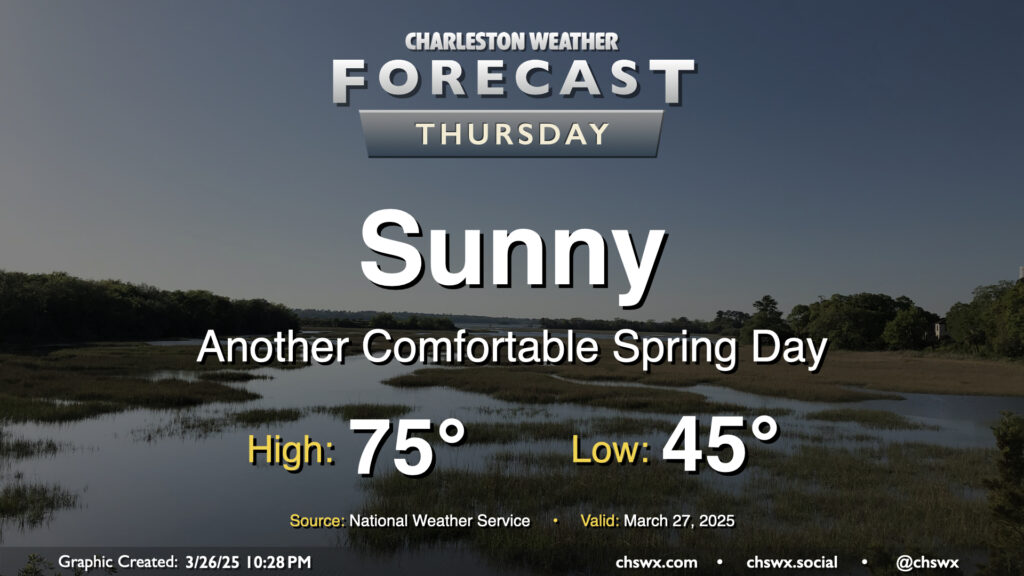
Another nice day is ahead for Thursday as high pressure slides by to our north. Temperatures start in the mid-40s, warming to the mid-70s under sunny skies for one more day. With the center of high pressure shifting more north of the area, winds will swing around more to the northeast and the east. It’ll be another dry day, relative humidity-wise, especially away from the coast as dewpoints mix down to the 30s in the afternoon. An inland-moving seabreeze will send dewpoints up into the low 40s as we get later into the day, but it’ll still feel quite comfortable outside.
Friday & the weekend: Turning a bit more humid — and, eventually, unsettled
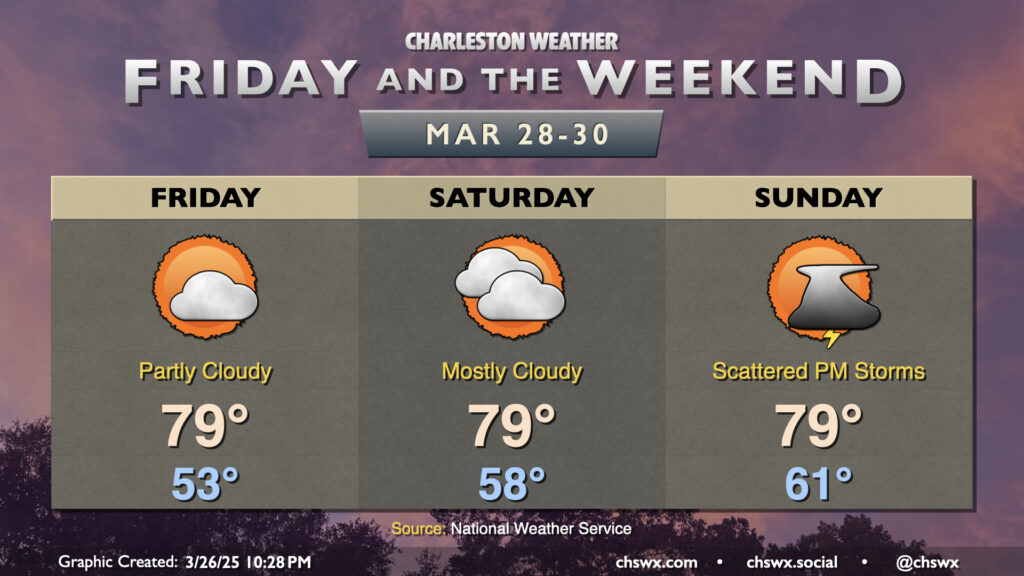
High pressure will begin to slip offshore Friday, and with that, return flow from the south will develop, driving temperatures and dewpoints upward as we head into the weekend. We’ll start to notice this on Friday as we start the day in the low-to-mid-50s, warming to near 80° in the afternoon with a few more clouds than we’ve seen the past few days. Moisture starts to return to the area in earnest on Saturday, which will yield partly to mostly cloudy skies, but no rain (yet). Some mid-level energy working through the area on Sunday could bring us some showers and thunderstorms in the afternoon, though nothing severe is expected from that round. Temperatures will remain warmer than normal for the end of March, with highs generally in the upper 70s to near 80° each afternoon despite the cloud cover.
Looking ahead: Stronger storms possible Monday
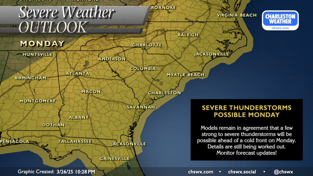
We continue to keep an eye for the potential for a few stronger to even severe storms on Monday as a surface cold front approaches the area from the west. While there are still plenty of discrepancies in the details, models generally agree that a decent low-level jet and some instability will coincide to allow for a few storms to possibly be strong to severe as we get into Monday afternoon and evening. Many details need to be worked out, and this isn’t necessarily a slam dunk nor is it a prediction of a major outbreak — just something to watch for now. As always, stay tuned…
Follow my Charleston Weather updates on Mastodon, Bluesky, Instagram, Facebook, or directly in a feed reader. Do you like what you see here? Please consider supporting my independent, hype-averse weather journalism and become a supporter on Patreon for a broader look at all things #chswx!