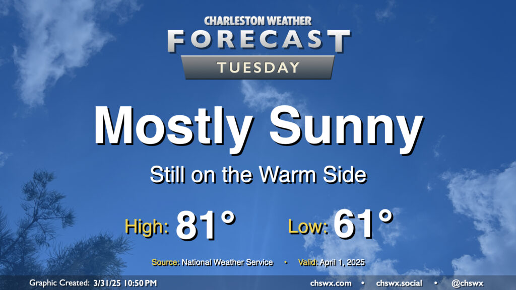
Tuesday: Quieter, still warm

After a raucous evening, we’ll have a much quieter Tuesday ahead as high pressure builds back in behind the cold front. The post-frontal airmass won’t feel much like a cold front came by, though, as temperatures will only come in a couple clicks below where they did on Monday (83° ended up as the day’s high temperature). Generally speaking, expect lows in the low 60s to warm to the low 80s in the afternoon under mostly sunny skies.
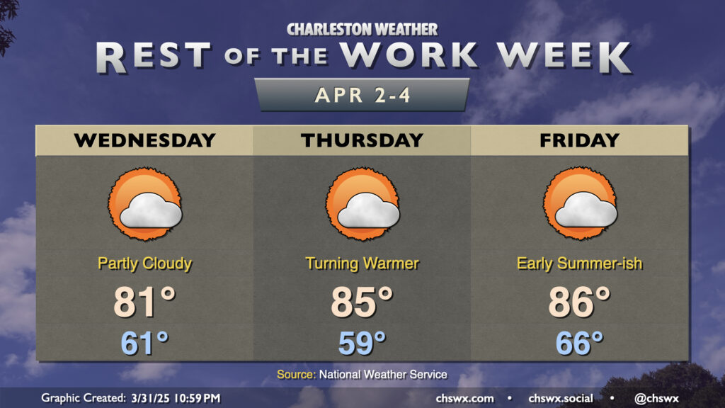
Rest of the work week: Staying quiet, turning even warmer

Quiet weather will continue for the rest of the work week with high pressure aloft and at the surface the main weather features. Wednesday will be another seasonably warm day, with lows in the low 60s warming to the low 80s in the afternoon under generally partly cloudy skies. There’s an outside risk of a stray shower, but the chance is so low as to be otherwise unmentionable.
Surface high pressure then slips offshore Thursday. While we get the day off to a slightly cooler start, temperatures turn much warmer Thursday afternoon, kicking off a stretch of the warmest days so far this year. Highs on Thursday and Friday should hit the mid-80s before the seabreeze kicks in, while we might run even warmer — perhaps flirting with 90° — over the weekend ahead of the next front. We should stay rain-free through Saturday before shower chances tick back up with the front later Sunday.
Follow my Charleston Weather updates on Mastodon, Bluesky, Instagram, Facebook, or directly in a feed reader. Do you like what you see here? Please consider supporting my independent, hype-averse weather journalism and become a supporter on Patreon for a broader look at all things #chswx!