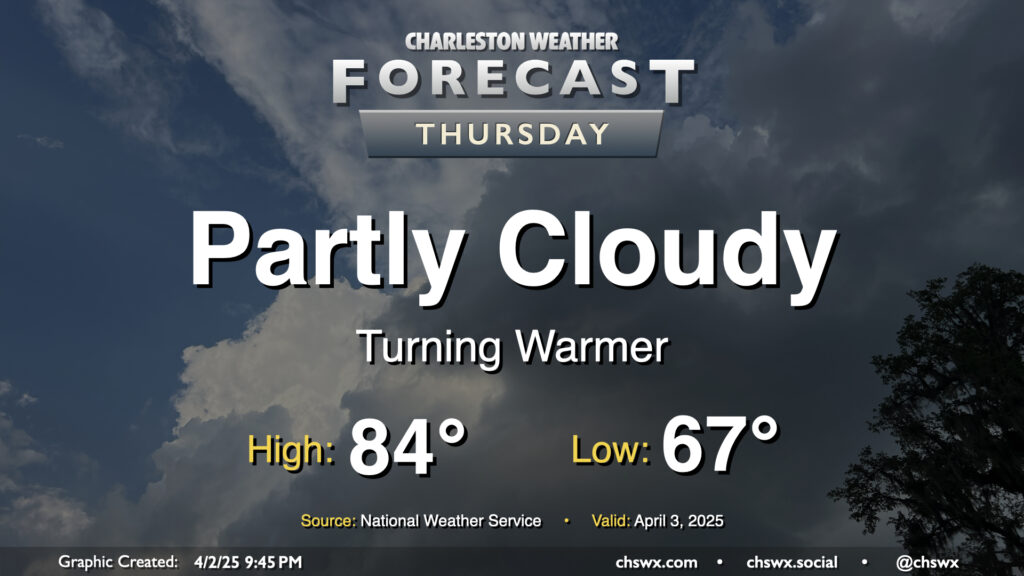
Thursday: Turning warmer as Atlantic high pressure takes charge

Atlantic high pressure at the surface and aloft will bring on progressively warmer weather as we hit Thursday and the rest of the Bridge Run weekend. We may set some record warm low temperatures during this stretch, starting with Thursday’s forecast low of 67°, which would tie the record warm low set in 2012. It’ll be a partly cloudy day, and the increasing influence of high pressure will keep any shower activity at bay (unlike what a few of us saw on Wednesday as a warm front lifted north). Temperatures will head to the mid-80s in the afternoon, which should get us right into some of the warmest air so far this year.
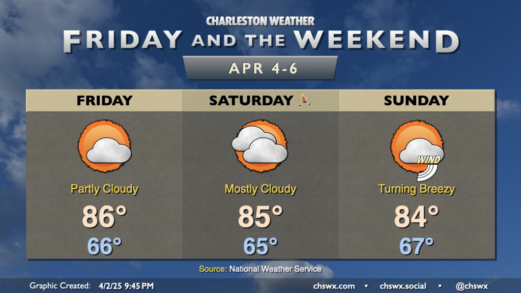
Friday & the weekend: A warm Bridge Run weekend

Warmer temperatures await as we get into the meat of Bridge Run weekend. Low temperatures will still run well on the mild side of normal with mid-60s expected each morning through Sunday. Record warm low temperatures could again be challenged Saturday and again on Sunday, in fact. Highs each afternoon generally top out in the mid-80s away from the locally cooler coastline before the seabreeze pushes through.
As we get into Sunday, we’ll start to see winds begin to pick up ahead of the next cold front. There may be a chance for a late shower or storm, but the better rain chances arrive on Monday. Once that front is through, temperatures fall off a cliff starting Tuesday; expect lows in the upper 30s to low 40s and highs in the 60s next week — quite a difference, to put it mildly!
Follow my Charleston Weather updates on Mastodon, Bluesky, Instagram, Facebook, or directly in a feed reader. Do you like what you see here? Please consider supporting my independent, hype-averse weather journalism and become a supporter on Patreon for a broader look at all things #chswx!