Tuesday: Cooling off, drying out
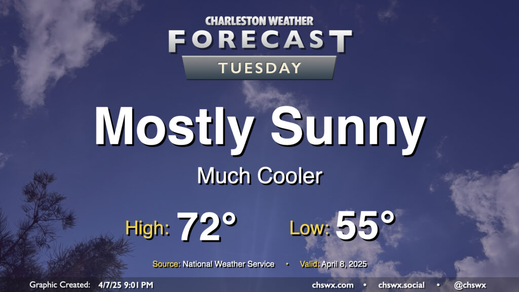
After a cold front comes through late Monday, Tuesday will turn out to be a much cooler and quieter day (weather-wise, anyway) as the front sweeps away the past week and change of more summerlike conditions. We’ll start Tuesday in the mid-50s, warming to just the low 70s in the afternoon under mostly sunny skies. It’ll feel quite different, but a bit more like early-to-mid-April, too.
Rest of the work week: Even cooler Wednesday, then warming back up; showers possible Friday
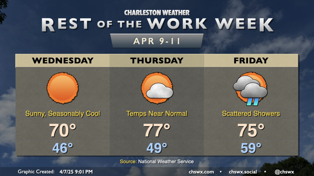
High pressure moves by to our north on Wednesday, and with it comes the coolest day of the set as lows fall to the mid-40s by daybreak Wednesday. Despite full sunshine, winds out of the northeast around 10-15 mph will help keep highs suppressed to around 70°, about 6° below normal for April 9.
Temperatures begin to rebound on Thursday as high pressure departs into the Atlantic. Lows around 50° will warm to the mid-to-upper 70s in the afternoon with a few more clouds as the next cold front encroaches upon the Southeast. This front will bring us our next rain chance on Friday. Instability will be limited, and so no severe weather is expected — just a scattering of showers. We’ll get off to a relatively mild start with lows near 60° warming to the mid-70s in the afternoon, with the expectation that clouds and showers will act as a governor on any additional warming.
Below-normal temperatures return for a few days behind the front. While a stray shower is possible on Saturday, Sunday looks excellent with lows in the upper 40s warming to the low 70s in the afternoon under plenty of sunshine.
Follow my Charleston Weather updates on Mastodon, Bluesky, Instagram, Facebook, or directly in a feed reader. Do you like what you see here? Please consider supporting my independent, hype-averse weather journalism and become a supporter on Patreon for a broader look at all things #chswx!