Thursday: Turning a little warmer; next rain chance Friday
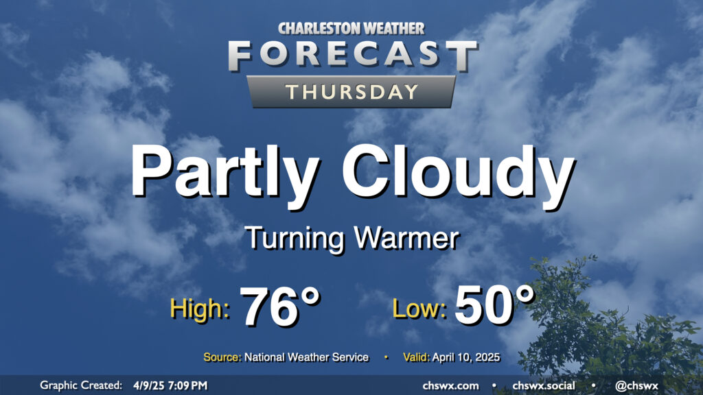
High pressure to our north, which has kept a cooler onshore flow in place that limited highs to the low 70s today, will slip offshore for Thursday, and we turn a bit warmer as a result. Expect to start Thursday right around 50°, just a touch below April 10 normals, warming to the mid-70s in the afternoon under partly cloudy skies. Should be a pleasant springtime day, all in all, especially if you like it a little warmer.
Friday & the weekend: Next front brings showers for Friday followed by another cooldown
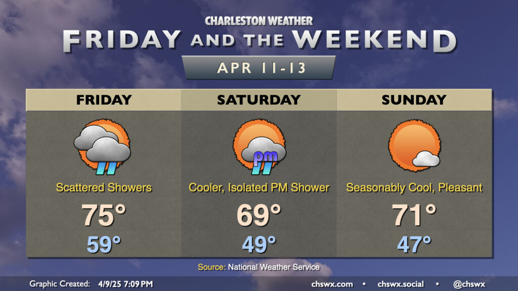
The next front comes through on Friday; it’ll bring a scattering of showers to the area throughout the day, though chances will diminish as we get into the evening as the front moves by. Temperatures on Friday start out on the mild side, with lows in the upper 50s to around 60° expected. We’ll warm to the mid-70s ahead of the front, likely governed by the shower activity. A rumble of thunder isn’t totally out of the question, but it overall looks unlikely.
Once the front gets by, cooler and drier air will work into the area for the weekend. We may not get out of the 60s on Saturday in the wake of the front. A stray afternoon shower is possible associated with energy to the north scraping by, but otherwise, we should stay mostly rain-free, especially in the morning. Sunday turns a touch warmer, but will still run well below normal with lows in the mid-to-upper 40s and highs in the low 70s expected under nearly full sunshine.
The 80s return briefly for Monday and Tuesday, but another front knocks temperatures back a little bit closer to normal on Wednesday.
Follow my Charleston Weather updates on Mastodon, Bluesky, Instagram, Facebook, or directly in a feed reader. Do you like what you see here? Please consider supporting my independent, hype-averse weather journalism and become a supporter on Patreon for a broader look at all things #chswx!