Thursday: A couple storms possible, otherwise partly cloudy

A few more storms will be possible Thursday as the lingering stalled front hangs around a bit longer. This, combined with the seabreeze, keeps a slight chance for storms in the metro in play for a good bit of the day, though the rain chance should diminish as the seabreeze pushes further inland. Temperatures will still be on the warm side of normal, but cloud cover, storms, and onshore flow should keep highs suppressed to the low 80s.
Friday & the weekend: Unsettled and quite warm at times
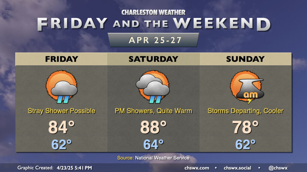
Temperatures warm back up into the mid-80s for Friday as the nearby front falls apart. We’ll keep a shower or two possible in the afternoon as the seabreeze pushes inland, but overall expect a quieter day precip-wise.
Saturday is the warmest day of the set; we start in the mid-60s and warm well into the upper 80s, perhaps flirting with 90° in a couple spots under partly cloudy skies ahead of another cold front, which will drive shower and storm chances up in the late afternoon through the overnight as it approaches. We should get a decent bit of the day in rain-free, though.
Storms depart by Sunday morning, and cooler and drier air will filter in behind the front. Temperatures fall back to the upper 70s for Sunday afternoon, right around normal for late April. This will kick off a generally quiet period of weather through at least Wednesday, with temperatures warming up as time goes on.
Follow my Charleston Weather updates on Mastodon, Bluesky, Instagram, Facebook, or directly in a feed reader. Do you like what you see here? Please consider supporting my independent, hype-averse weather journalism and become a supporter on Patreon for a broader look at all things #chswx!