Tuesday: Another sunny day with some late-evening coastal flooding possible
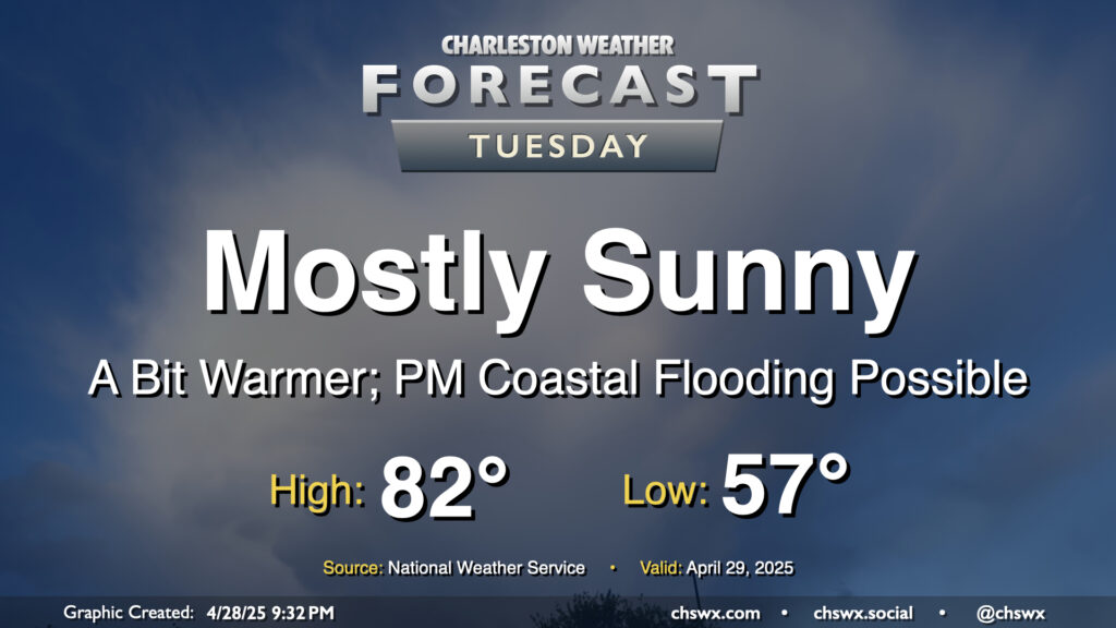
Another seasonably warm and mostly sunny day is on tap for Tuesday as high pressure remains in control. We’ll start the day on the cool side of normal once again, with lows in the mid-to-upper 50s expected away from the coastline. Then, temperatures warm to the low 80s in the afternoon with plenty of sunshine throughout. Don’t forget the SPF!
We will still need to monitor tides in the late evening as water levels should peak between 7-7.2’ mean lower low water in Charleston Harbor a little before 10:30 PM. Some minor salt water flooding will be possible an hour or two around the time of high tide as a result, and another coastal flood advisory appears probable. This should do it for this high tide cycle, though, as astronomical influences wane and winds turn more unfavorable starting Wednesday.
Rest of the work week: Turning warmer, maybe a storm or two Friday
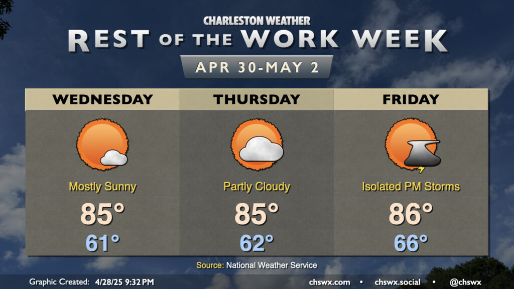
High pressure will begin to shift offshore by mid-week, and temperatures will begin to respond to the more southerly flow on the backside of the high as a result. Wednesday starts a bit warmer than the previous couple days with lows in the low 60s, and we’ll warm into the mid-80s in the afternoon. Expect similar conditions for Thursday with perhaps a few more clouds in the afternoon.
The next thunderstorm chance arrives Friday, with a storm or two possible in the afternoon into the evening as another cold front approaches the area. Storm chances tick up overnight into Saturday, with the front expected to come through later Saturday.
Follow my Charleston Weather updates on Mastodon, Bluesky, Instagram, Facebook, or directly in a feed reader. Do you like what you see here? Please consider supporting my independent, hype-averse weather journalism and become a supporter on Patreon for a broader look at all things #chswx!