Thursday: First 90s of the year expected
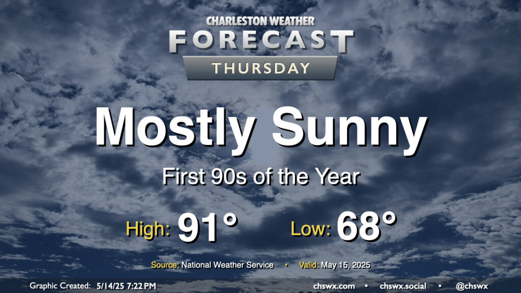
Wednesday was the warmest day thus far of 2025, with a high of 89° recorded at the airport. This distinction will be short-lived as high pressure continues to build in on Thursday, sending us to what should be our first 90° readings of the year in the afternoon. Mostly sunny skies are expected to prevail, so be sure to apply sunscreen if you are headed outside for a little pre-summer preview.
Friday & the weekend: Turning even warmer
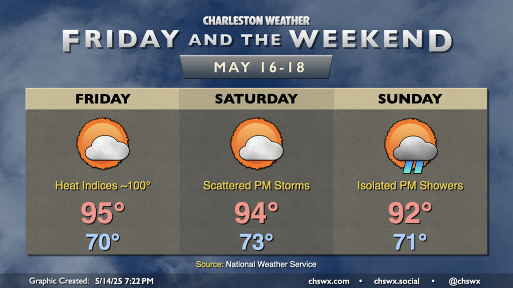
The heat continues to build heading into Friday and the weekend. It’ll be very summer-like, with temperatures running above normal for mid-July, much less mid-May. Upper 60s to low 70s dewpoints will keep heat indices from going too crazy, but humidity will still make an impact and send the heat index to around 100° each afternoon, particularly immediately after the seabreeze pushes inland as higher-dewpoint maritime air surges in before cooling things off a little. High pressure at the surface and aloft keeps us largely rain-free, though we may see a little energy stir up a stray shower or two Sunday afternoon into the evening. Above-normal temperatures continue into next week, though not quite to the degree we’ll see this weekend.
Follow my Charleston Weather updates on Mastodon, Bluesky, Instagram, Facebook, or directly in a feed reader. Do you like what you see here? Please consider supporting my independent, hype-averse weather journalism and become a supporter on Patreon for a broader look at all things #chswx!